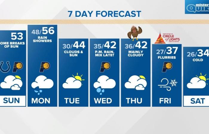
Tracking a mid-week storm system that could bring rain and snow and disrupt holiday travel plans.
INDIANAPOLIS — We’re tracking a mid-week storm system that could bring rain and snow and disrupt holiday travel plans.
Here’s the latest track and timeline:
Credit: WTHR
BUT FIRST…A BRIEF WARMER TREND
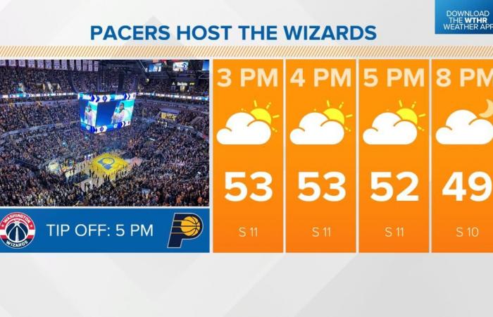
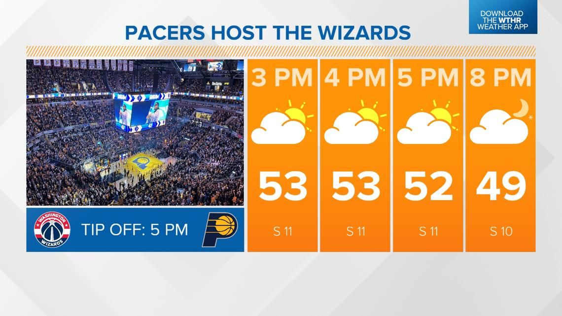
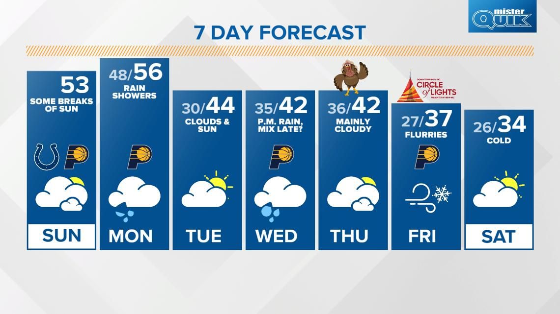
After a cloudy and cool start, warmer air returns this afternoon with highs in the low to mid 50s. While skies stay mainly cloudy, we will see a few peeks of sunshine through the cloud cover.

Credit: WTHR
RAIN GEAR READY MONDAY
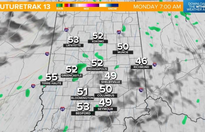
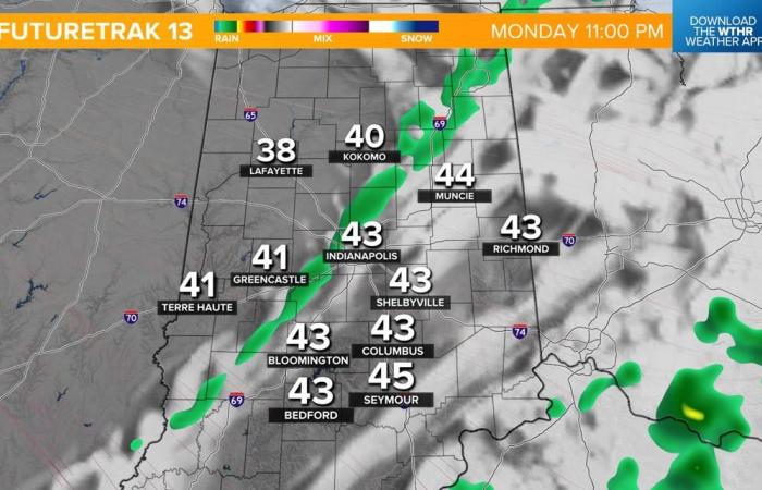
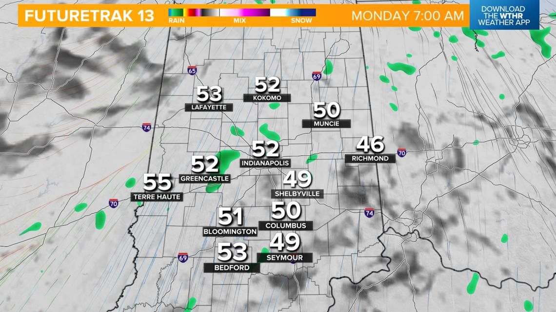
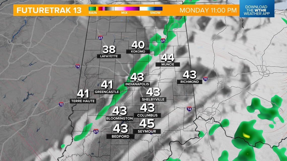
Our next weather system arrives overnight and brings in stray rain showers by daybreak Monday. Temperatures hold steady in the upper 40s and low 50s. Scattered rain will then continue through the day tomorrow. We’ll still be in the “warm sector” of this weather system, which allows temperatures to recover to the mid 50s ahead of the cold front coming through late Monday night.

Credit: WTHR

Credit: WTHR
Arctic blast arrives Tuesday, cold snap for Thanksgiving holiday
Much cooler air returns by Tuesday as skies start to clear out. Highs Tuesday in the low to mid 40s will kick off a stretch of below average temperatures with highs only in the low 40s through Thanksgiving and then only in the 30s starting Friday into next weekend.
Mid-week storm system potential travel impacts
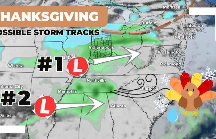
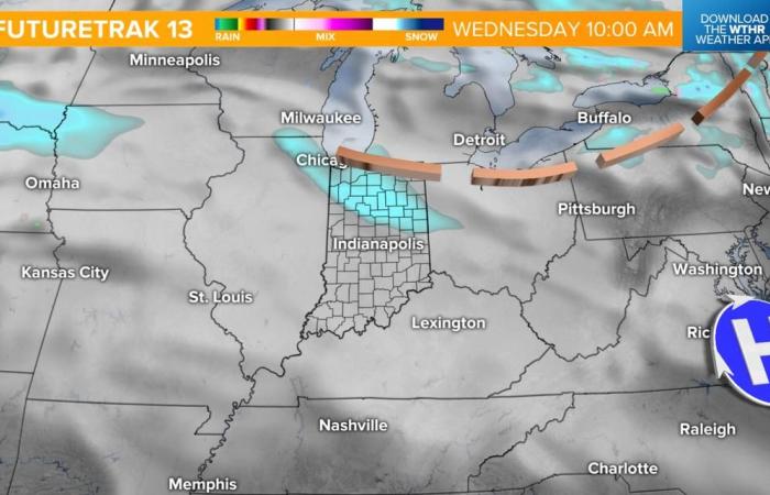
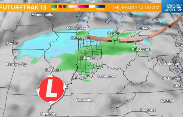
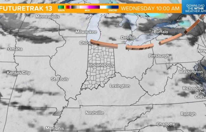
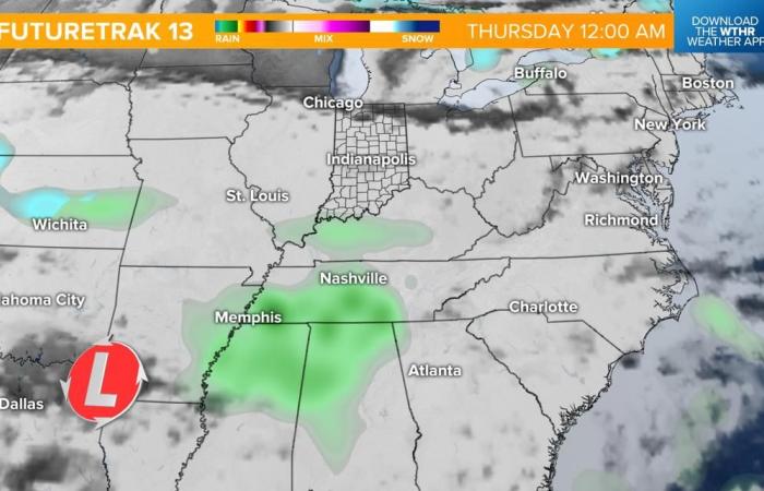
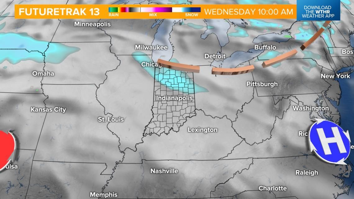
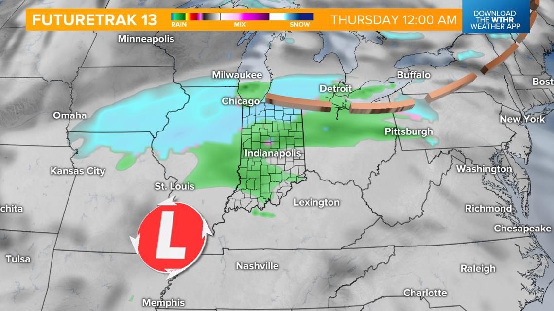
Confidence in this forecast remains low as there are several discrepancies from model to model and run to run of those outlooks. With that being said, it does look like a storm complex will emerge out of the west starting Wednesday, which could impact holiday travel.
Scenario 1: Storm track lifts northeast and intensifies bringing a combination of rain south and snow north late Wednesday into Thanksgiving morning.

Credit: WTHR

Credit: WTHR
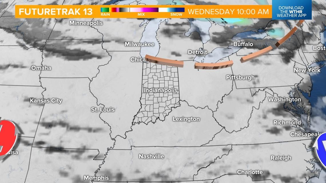
Scenario 2: Storm track stays south and keeps most of the area dry both Wednesday and Thursday with the best chance of precipitation being a rain chance late Wednesday night and early Thanksgiving day morning across southern Indiana.

Credit: WTHR


Credit: WTHR
Regardless of storm track, Thanksgiving day looks dry with the exception of a few lingering showers in the morning. Highs in the low 40s.
Colder extended forecast
Behind the Thanksgiving storm system will be a more quiet set-up but also the risk of much colder air settling in from a Canadian air mass. The Climate Prediction Center gives central Indiana an 80% chance of below average temperatures through early next week.

Credit: WTHR

