Par
Laurent REBOURS
Published on
Nov. 20 2024 at 2:26 p.m
See my news
Follow Chartres News
Storm Caetano will affect the entire country this mid-week. As Météo France reports, it causes a first early winter episode for the season, with sometimes violent winds and the snow down to the plain. Under the influence of a descent of polar air, temperatures drop to levels worthy of January on Thursday and Friday.
Dangerous phenomena are predicted. Météo France urges the greatest caution when traveling by consulting the Meteorological Vigilance website (by clicking on the department) and following the behavioral advice.
Orange warning for snow and ice
Since this Wednesday, November 20, 2024, many departments have gone into orange snow and ice vigilance, including Eure-et-Loir, Loiret, Loir-et-Cher, Eure, Orne, Sarthe and Mayenne. .
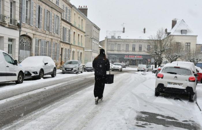
For this Thursday November 21, 2024the Caetano depression crosses central France from west to east and will generate a significant air mass conflict. North of this depression, snowfall down to the plain is expected between the end of the night from Wednesday to Thursday and the evening of Thursday, from Brittany to Center-Val-de-Loire, via the Normandie.
Predictability and uncertainties
The exact path of the depression will determine the areas affected by snow and strong gusts of wind.
■ Snow episode : For the Cher department, “a change to orange snow-ice vigilance is possible in the event of a worsening of the forecast” indicates Météo Center.
■ Windy episode : Depending on the exact positioning of the low pressure center, wind gusts could around 100 km/h inland between Loire-Atlantique and Cher, reaching 110-120 km/h along the coasts of Loire-Atlantique and Vendée. An orange wind alert could be triggered if the forecast changes in this direction.
Developments planned for the Centre-Val de Loire
From 5 a.m. Thursday, the first snowfalls affect northern Brittany, particularly the interior. Snow alone quickly replaces mixed rain and snow. The disturbance progresses Thursday morning towards Normandy, the north of Pays-de-la-Loire before reaching Center-val-de-Loire after 10 a.m. Precipitation is low but continuous.
They gradually weaken from the west during the afternoon. On the departments of Centre-val-de-Loire in orange, they persist a little after 7 p.m..
Throughout the episode, we wait 1 to 5 cm of snow on the ground, locally 10 cm on relief areas (interior of Brittany and Normandy).
” Of the rule phenomena are expected the following night, hence the extension of the orange vigilance” adds Météo France.
Follow all the news from your favorite cities and media by subscribing to Mon Actu.


