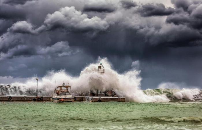
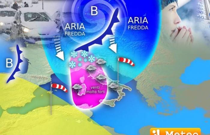
Lorenzo Tedici, meteorologist of the website www./, unfortunately confirms the arrival in Italy of the ‘perfect storm’, a deadly mix of wind, cold and snow: obviously it will not be perfect as it will bring inconvenience and damage, especially due to the wind that will blow very violently from the west, building in the open sea giant waves up to 7 meters on the Ligurian Sea.
In detail, the sea will become rough from this afternoon on the Ligurian sector with waves of up to 4 metres, then in the evening it will be rough (Douglas scale) on the coasts of Eastern Liguria and Tuscany with waves of 5-6 metres. The highest waves will reach the extreme and exceptional height of 7 meters in front of the Tuscan coast of the Ligurian Sea (between Versilia and Livorno). Unfortunately it will be a historic Libeccio storm with potential damage on the exposed coasts.
On Wednesday other waves up to 5 meterswith very rough seas, will also hit the Lazio coasts and the north of Sardinia (primarily the Strait of Bonifacio): the winds will rotate during the day from Libeccio (south-west) towards Maestrale (north-west).
The Mistral on the night between Wednesday and Thursday will also be impetuous in Campania and Tyrrhenian Calabria and then insist on most of the southern basins during the day. On Thursday, at the same time, we will also have a second Libeccio storm with waves of up to 4-5 meters on the Ligurian Sea, descending towards the south in the evening. In practice, the “perfect storm” will have at least two phases of impetuous wind from the south-west, west, north-west: the wind will be dangerous from Tuesday afternoon until at least Saturday morning and the seas will repeatedly hit the coasts.
After the wind the rains will also come: in particular, from Wednesday to Friday it will always rain in the same areas, the Tyrrhenian ones from Tuscany to Lazio, to Campania and up to Calabria. In these regions, rainfall amounts could be significant, well over 100-150 liters per square meter in 3 days.
Ma the other most important aspect of the perfect storm will be snow: it will initially fall in the Alpseven moderate, above 1000 meters with more significant accumulations in the Aosta Valley and on the border mountains. On Wednesday we will also have a whitewash on the Apennines above 1400-1500 metres, but the day to mark with the blue pencil will be Thursday 21 November.
On Thursday the snow could fall all the way to the plains, especially in Piedmont. From the evening onwards, choreographic showers cannot be ruled out also on the Triveneto, on the northernmost plains of this area. Also in Milan on Thursday there will be a snowflake hunt, looking at the street lamp against the light; at the moment significant accumulations are expected only in Piedmont and Valle d’Aosta but we will have to monitor the situation carefully also for all road arteries in the hills or high plains. Among other things, with the movement of the Arctic air mass towards the south-east, we will have local snow phenomena on the plains on Friday morning still in the Triveneto and above all in the central-northern Apennines up to hilly altitudes.
In short, for 3 days the perfect storm, or rather ‘imperfect’ due to the potential damage, alerts and inconveniences, will rage over our country from North to South.
In detail
- Tuesday 19. In the North: sky at times very cloudy or foggy in the plains; snow in the Aosta Valley in the evening. In the Center: some rain in upper Tuscany, many clouds elsewhere; the Libecciata arrives. In the South: scattered rains on the Tyrrhenian sector. Wednesday 20. In the North: it worsens quickly in the Alps with snow, gradually sunnier elsewhere. In the Center: Libeccio storm, bad weather on the Tyrrhenian Sea. In the South: bad weather in Campania and Tyrrhenian Calabria, very strong winds.
- Thursday 21st. In the North: snow possible from the afternoon/evening up to the plains. In the Center: very strong winds, bad weather on the Tyrrhenian Sea. In the South: bad weather, very strong winds. Trend: bad weather and wind especially in the Centre-South, cold and snow at low altitude. Improved from Saturday.


