A very active cold front is preparing to sweep across France in the coming hours, accompanied by sometimes significant amounts of rain. What should you actually expect? Which regions will be most affected by this heavy precipitation?
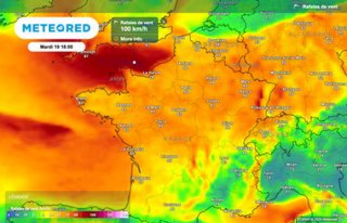
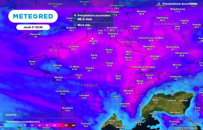
A particularly active cold front is preparing to cross a large part of France in the coming hours. Accompanied by strong gusts of wind, this front will also bring very heavy precipitation tomorrow. Rainfall accumulations could locally exceed 50 liters of water per square meter.
In certain regions, the accumulations could even be a little higher, locally reaching 70 to 80 liters of water per square meter between today and tomorrow.
These heavy rains will put an end to the anticyclonic blocking situation which has persisted in France for more than two weeks. After the passage of this very active cold front, a descent of maritime polar air will take place over the country, leading to a marked drop in temperatures and a probable arrival of snow in the plains from Thursday.
Heavy rains over a large part of France
Already sustained rains have been affecting the regions of the northern half for several hours, with accumulations already reaching 30 to 50 mm between Seine-Maritime and Oise.
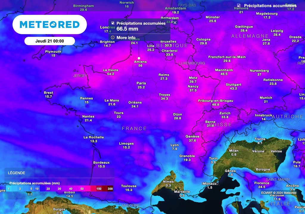
This rainy weather will persist this Monday afternoon in the regions located north of the Loire, with even more marked intensities between Normandy and Picardy.
A very rainy Tuesday!
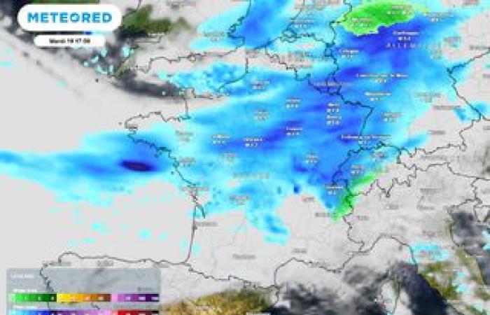
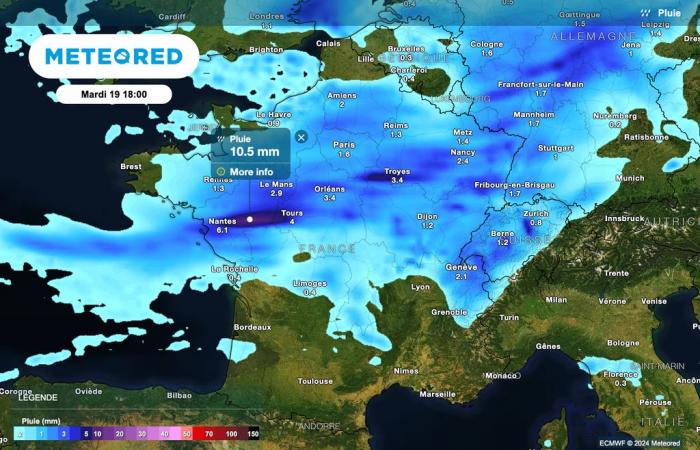
Tuesday also promises to be very rainy, with a cold front which will gradually progress over the hours.

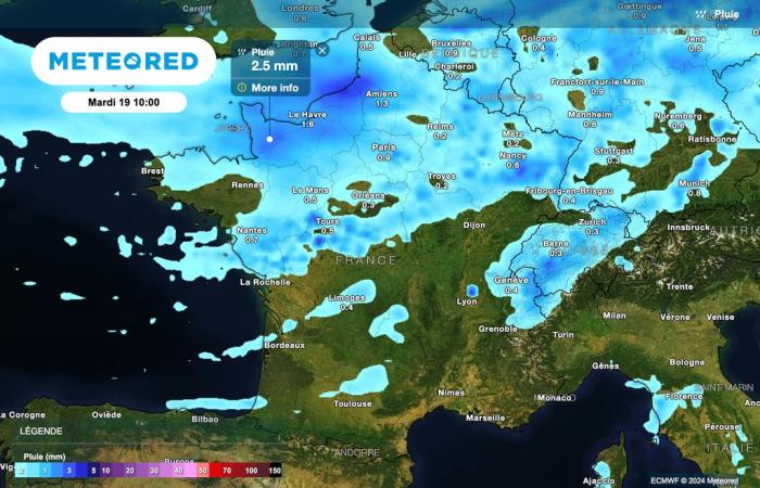
In the morning, it is mainly the northern half of the country which will be affected by the rains linked to the cold front. However, precipitation will be lower towards the southwest.
The weather will still remain bright between the Pyrenees and the Mediterranean rim. Please note, however, that there will be rain in western Corsica.
The rain gains ground during the day
The rains will progress towards the south throughout the day. The accumulations of rain will be particularly significant along the Channel, notably between the English Channel and Pas-de-Calais.
Significant accumulations will also affect the western foothills of the Massif Central, as well as the regions of Morvan, Jura and the Northern Alps, with accumulations which could exceed 60 to 70 liters of water per square meter.
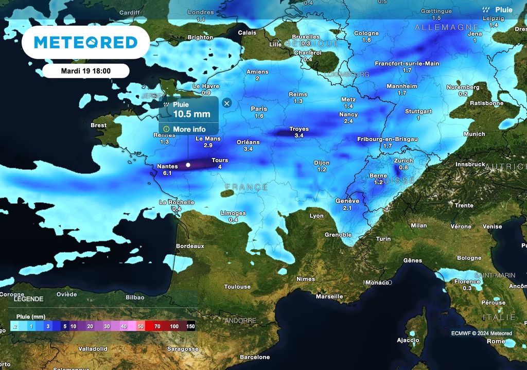
Once again, the Pyrenees and the Mediterranean regions will do well, benefiting from dry weather accompanied by some nice clearings.
Maritime polar flow!
While the cold front will gradually progress towards the south of the country, an air mass of polar origin will rush in behind from the far north.
It is this descent of polar air which will be the cause of a marked drop in temperatures between Wednesday and Thursday in the north of the country, with values which will locally fall 5 to 7 degrees below seasonal norms.
Indeed, Thursday afternoon, maximum temperatures will struggle to exceed the 5 degree mark in the north of the country, even at the best time of the day.


