Winter storm over Europe –
It will be stormy on Tuesday – then snow will fall “all the way down”
The first winter storm will hit Switzerland from Tuesday to Wednesday. Gusts of up to 80 km/h are expected in the lowlands. As a result, it becomes wintery.
Published: November 17, 2024, 2:30 p.m
In the second half of the week it will be wintry in Switzerland – there will be snow and frost even at lower altitudes.
Photo: Keystone
Subscribe now and benefit from the read-aloud function.
BotTalk
- A winter storm will hit Switzerland on Tuesday.
- The cold front is expected to cause wind peaks of up to 80 km/h in low areas.
- Heavy gusts of over 100 km/h are possible on Jura heights and Alpine peaks.
- Shower-like precipitation may sometimes fall as snow at lower altitudes.
Switzerland is facing the first “real” winter storm of the season. On Tuesday the wind will increase noticeably at all altitudes. A cold front will reach Switzerland later on Tuesday evening. This is part of a storm depression that is moving with its core over northern Germany. It is the start of a windy, wet and increasingly wintry period of weather as the week progresses.
The – long overdue – change to the large-scale weather regime over Europe began on Saturday. The high pressure area that had previously been rock solid was gradually reduced and lost its influence. Relatively little of this was noticeable on the ground. In the higher air layers, the so-called cyclonicization of the flow was already noticeable: the wind became stronger, turned to the west, and it became colder.
Polar front is pushed south
In meteorology, cyclonic means that the air is directed in a counterclockwise direction around a low pressure area. The opposite of this is anticyclonic, where air flows clockwise around an area of high pressure.
This cyclonic weather character will intensify further in the coming days. A powerful low-pressure area filled with cold air at altitude, a so-called high-altitude trough, is expanding from the North Atlantic into Europe. The polar front, which marks the boundary between the cold air masses of the polar region and the milder air masses of the subtropics, is being pushed far south. On Monday it runs from Greenland across the British Isles to the Alpine region and on to the Black Sea.
Extremely opposing air masses meet along this frontal zone. In addition, very strong winds prevail, especially in the higher atmospheric regions. It is therefore not surprising that strong storms develop along this front. These then move from west to east and have a significant influence on the weather over Europe.
Strongest gusts of wind usually occur when the cold front passes through
In the next 48 hours, this weather pattern will be practiced in an exemplary manner. The air pressure will drop over the British Isles on Monday and a storm will form. This intensifies (“deepens”) and moves via northern Germany to Poland by Tuesday evening. In the core of the low, the air pressure averaged at sea level will drop to around 980 hectopascals or even slightly lower. The isobars, i.e. the lines of equal air pressure, crowd together around this core. There are significant pressure differences in a small space.
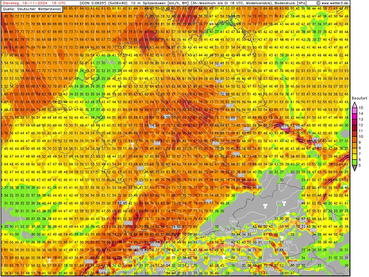
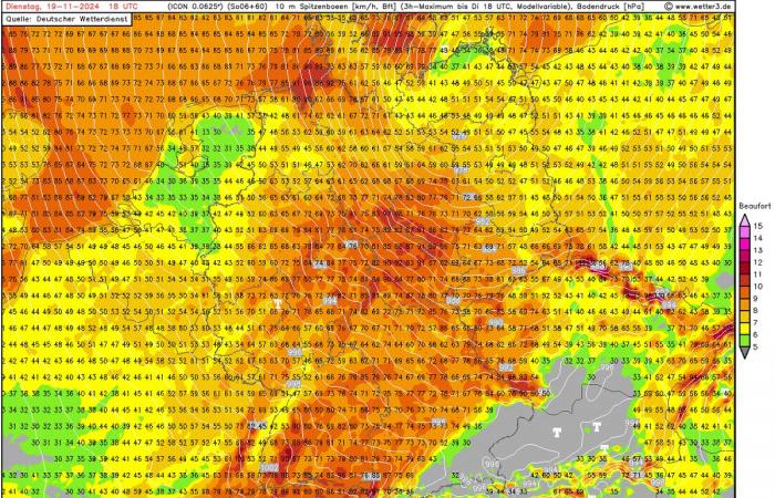
This is how the Icon model sees the situation over Central Europe on Tuesday (around 7 p.m.). The white lines are the isobars (lines of equal pressure). The core of the storm is over northern Germany, and the storm field extends to the Alpine region. In this phase, the cold front crosses the northern side of the Alps (at least according to this model).
Those: wetter3.de
The result: storm.
However, deep core pressure and crowded isobars alone do not make a storm noticeable even in the lowlands of the Swiss plateau. The “timing” of the front systems hanging on the storm depression also plays an important role.
European storm depressions usually consist of a warm front that precedes the depression. Behind this is the so-called warm sector. In this area, the low pushes relatively mild air masses. Isobar pressure and high-altitude winds are often strongest in this area of the low. However, the air masses are stably layered, which is why the strong high-altitude winds cannot blow down to the ground. In this phase, the storm is primarily taking place at higher altitudes (from around 1500 meters).
The warm sector is finally followed by the cold front of the low. Behind this there are increasingly colder air masses, which often originate in the polar region in winter. Because the atmosphere in the cold air is unstable, the so-called vertical momentum transport comes into play. This means that the strong winds at altitude can reach down to the ground. This is the reason why the strongest gusts of wind in lowland winter storms often only occur with the passage of the cold front or immediately afterwards.
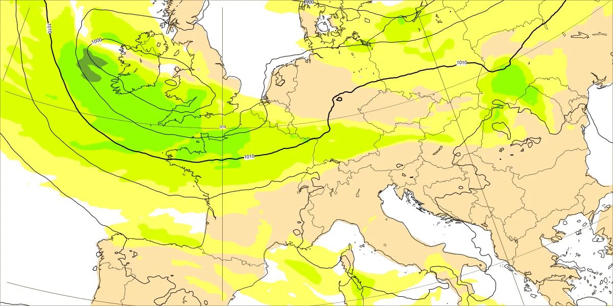
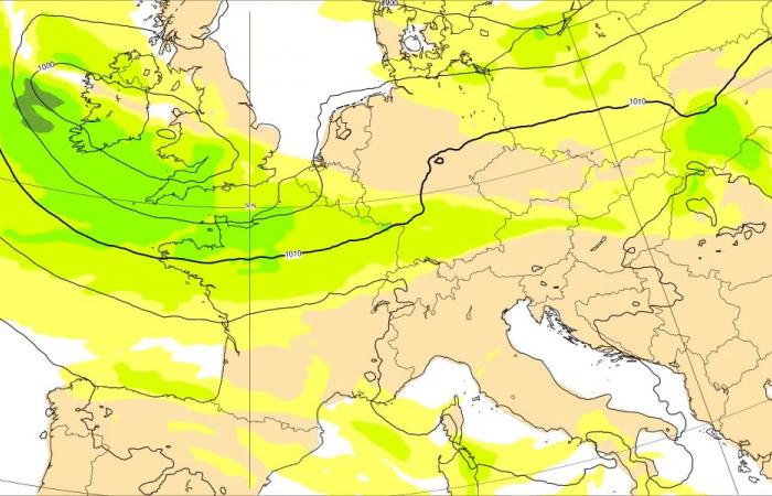
The animation shows the pressure conditions at sea level (lines) and the wind speed at an altitude of around 1500 meters from Tuesday night (November 19th) to Wednesday morning. The core of the storm is moving over northern Germany, and its storm field (green) is affecting large parts of Central Europe. At high altitudes, the low reaches wind peaks of up to 30 meters per second (equivalent to around 110 km/h).
Quelle: ECMWF
It is not yet completely clear how strong the storm winds will be in Switzerland on Tuesday. According to current weather models and also according to Meteo Switzerland’s assessment, the wind peaks in the lowlands when the cold front passes through are likely to be between 70 and 80 km/h. However, higher wind peaks can also occur in exposed areas (e.g. on hills or on lake shores).
The wind speeds are higher on the Jura heights and the Alpine peaks – heavy gusts of wind (over 100 km/h) can be expected there.
A severe storm situation, which could also cause widespread damage in the lowlands, is therefore not expected on the north side of the Alps. Significant damage to infrastructure and vegetation can be expected in this country if wind speeds of around 90 km/h or more occur over a large area.
Behind the storm, Switzerland comes into the influence of the already mentioned high-altitude trough. Highly unstable cold marine air flows into the Alpine region. This leads to shower-like precipitation, some of which falls as snow or sleet down to low altitudes. Even isolated thunderstorms are possible. It will be wet and cold in the lowlands, while deep winter conditions are likely to set in in the mountains.
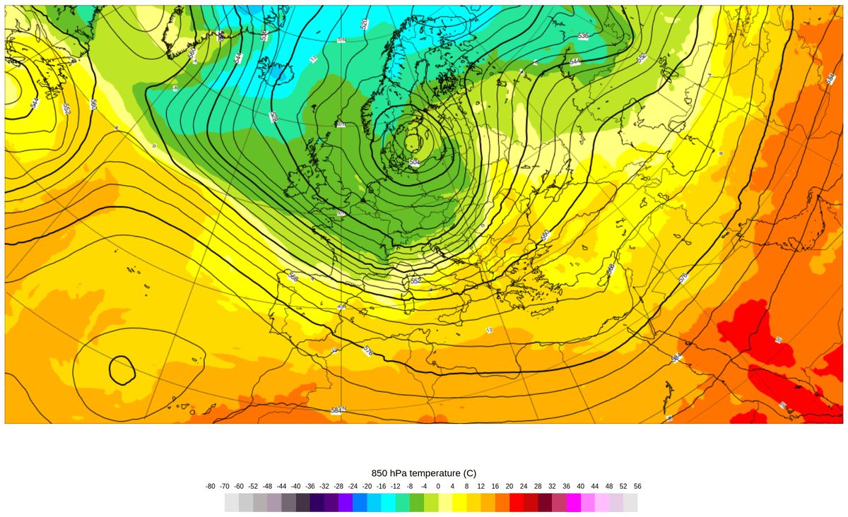
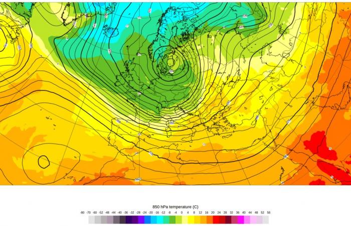
This is what the general weather situation over Europe looks like on Wednesday evening (colors: temperature at 1500 meters, lines: pressure conditions at 5500 meters). A powerful high-altitude trough has spread to the Mediterranean region. In the area of this trough, cold and unstable sea air flows high up to the Alpine region.
Quelle: ECMWF
This weather pattern is expected to continue on Thursday and Friday. The maximum daily temperatures are then only just above freezing point, even in the lowlands. Snow falls down to low altitudes and the nights become frosty.
Celsius
Get the most important background information and analyzes about climate and weather.
More newsletters
Log in
Found an error? Report now.
12 comments


