This Sunday, the first rains affect the north of France before the arrival of a significant maritime polar air mass. This phenomenon will have numerous consequences on the country: sometimes strong winds, marked cold and possible snowfall all the way to the plains. What will happen over the next few hours? Find our latest forecasts.
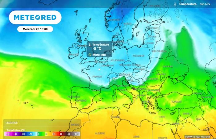
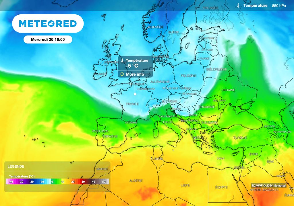
This has been announced for several days, and we will not escape it: a descent of maritime polar air will sweep over France at the start of next week, leading to a drop in temperatures between Tuesday and Wednesday. With a particularly dynamic jet stream, It will also be necessary to monitor the strong wind gusts expected. Moreover, the risk of snow reaching the plains will need to be monitored closely, particularly during the day on Thursday.
While waiting for this week which promises to be particularly turbulent and wintery, a change in the weather is gradually beginning today in the north of the country, with the arrival of a mild rainy disturbance.
What should we expect in the next few hours? What are the main points to remember for the coming week? Find our latest forecasts in this article.
The rain is coming from the north of the country!
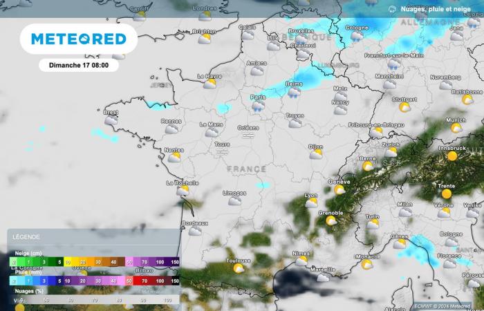
A disturbance of low activity is affecting the regions located in the north of the country this Sunday morning. The areas affected by this low precipitation are Brittany, Normandy, Île-de-France and Lorraine.

Ahead of the cold front, the sky is very cloudy, with many fogs and low clouds. Only the regions located between the Pyrenees, the Alps and the Mediterranean benefit from sunnier conditions this Sunday morning, although the sky is cloudy towards the Mediterranean.
Clouds are gaining ground this afternoon
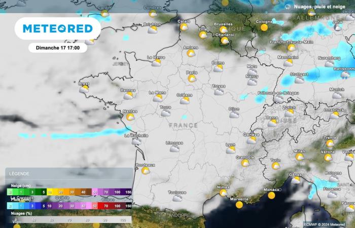
This afternoon, clouds will advance and rain will gradually spread to central regions over the hours. Some light snowfall is expected in the Vosges from 900 meters above sea level.

As shown in the map above, precipitation will remain very light this afternoon between La Rochelle and Strasbourg. Some clearings will even return to the north of the Seine, and they could be quite beautiful in the far north of the country.
Further south, the clouds will continue to gain ground, with gray skies and some drizzle. On the other hand, the weather will still be good in the Pyrenees, the Alps and the Provence-Alpes-Côte d'Azur region. Some light rain is also expected over western Corsica this afternoon.
Temperatures rising slightly
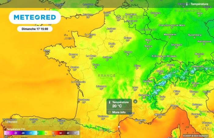
Temperatures will tend to rise slightly this afternoon, particularly in the north of the country. This increase will continue tomorrow, but it will be rather misleading, because the descent of maritime polar air will arrive just after!

The temperatures are expected to be very mixed this afternoon, with maximums ranging from 6°C in Nancy to 20°C in Perpignan. Between these two extremes, we forecast: 10°C in Lille and Nantes, 11°C in Paris, 12°C in La Rochelle and Aurillac, 13°C in Toulouse, 15°C in Biarritz, 17°C in Marseille and 18 °C in Montpellier and Bastia.
Next week promises to be hectic
Next week therefore promises to be very turbulent, with a dynamic jet stream, strong gusts of wind and a descent of maritime polar air which will cause a drop in temperatures between Tuesday and Wednesday. A winter atmosphere thus seems to settle in on Wednesday in the country.
Next week could be marked by the first snowfalls in the plains. However, the weather models still show discrepancies this Sunday regarding the precise evolution of the situation. It is therefore recommended to monitor the forecasts regularly to obtain up-to-date information.
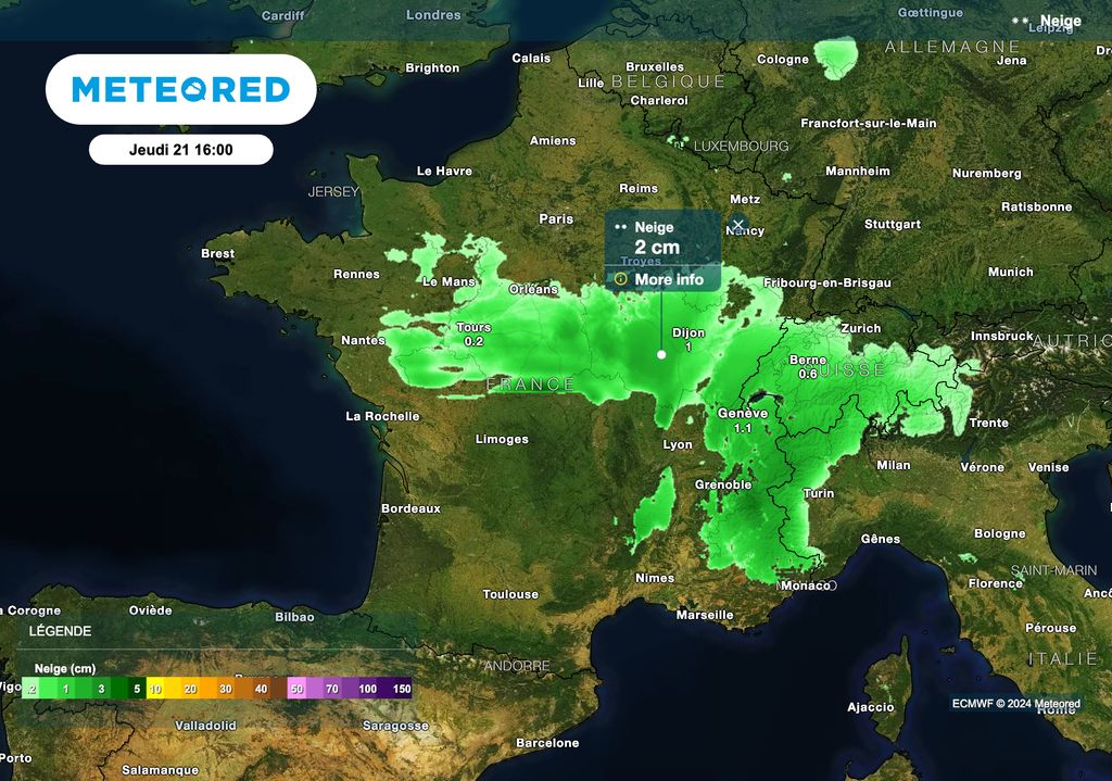
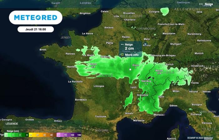
We will be watching for the arrival of a depression from the south-west of France on Thursday. In contact with the descent of maritime polar air over the north of the country, this configuration could cause snowfall in the large area where the air masses will collide.
There is therefore a risk of snowfall down to the plains on Thursday. However, as the deadline is still far away, these forecasts will be refined over the coming days.


