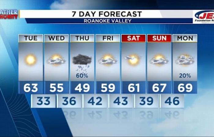
ROANOKE, Va. – Dry conditions are here for the next two days, then our next cold front marches through the region!
Winds will be sustained near 5-10 mph for most of Tuesday with winds gusting between 15 and 25mph at times. The winds gradually decline as we progress through the day.
More seasonable temperatures return for the day. However, we are still a couple of degrees above normal for the time of year. And if you like the cooler temperatures, I have some good news for you!
The overall setup for Wednesday favors mostly clear to partly cloudy skies and cool temperatures for the mid-Atlantic. Just to our west is our next weathermaker that will move in Wednesday night.
Here is a look at futurecast at 8 p.m. Wednesday night. Scattered showers overtake the region shortly after this!
By 9 a.m., a lot of the rain begins to move out toward the east. There will be isolated showers trekking behind. Some spots could also see some wintry precipitation, though, this will be extremely isolated to the west-facing slopes and mountain tops.
After all the rain moves through, our temperatures will remain cool, and the air will turn dry. Winds will likely pick up too.
To stay up to date on all things weather, download our weather app.
Copyright 2023 by WSLS 10 – All rights reserved.
Belgium


