
BISMARCK, N.D. (KFYR) – El Niño was first discovered in the 1600s by a South American fisherman when he noticed the water was warmer in December.
In normal patterns, there are trade winds over the Pacific Ocean. The trade winds blow east to west along the equator. This takes the warm water from South America towards Asia. El Niño and La Niña are opposing climate patterns.
Both patterns can have global impacts on everything from weather to economies, to wildfires, to ecosystems. Both El Niño and La Niña are cyclical. Both patterns usually last nine to 12 months each, but they could last for years. They are not on a regular schedule. La Niña and El Niño happen every two to seven years.
El Niño typically weakens the trade winds, which causes the Pacific jet stream to move south. This causes a chain reaction. The northern United States and Canada are drier and warmer than usual, but the U.S. Gulf Coast and Southeast are wetter than usual.
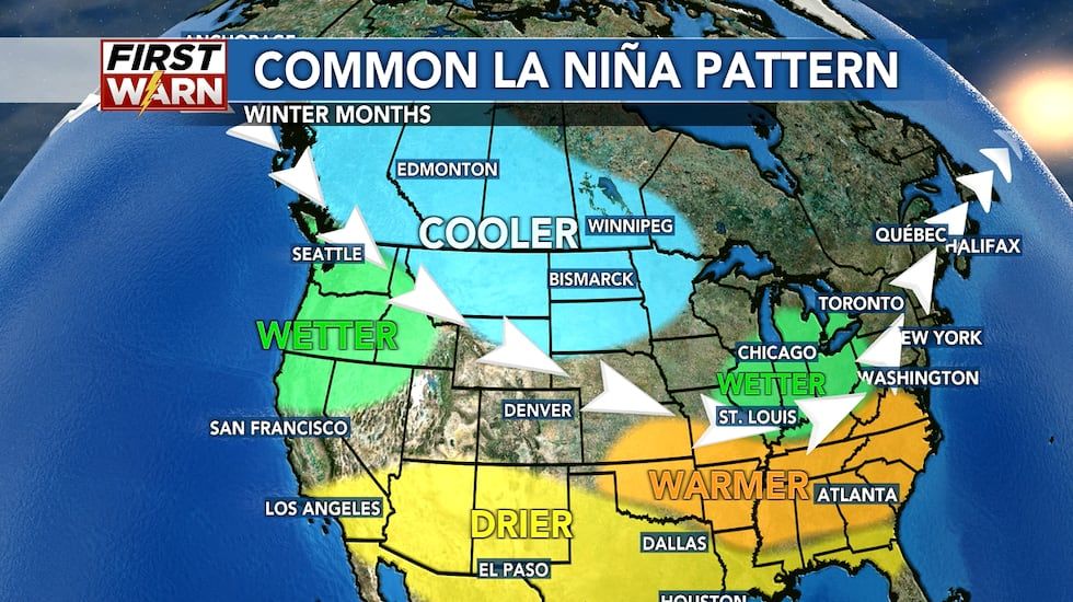
This year we are in La Niña. This means the trade winds are stronger and push the warm water towards Asia with the cooler water off the west coast of the Americas coming towards the surface. This pushes the Pacific jet farther north. La Niña tends to lead to a drought in the southern U.S., as well as heavy rains and flooding in the Pacific Northwest and Canada. Winter temperatures can also be colder than normal in the northern U.S., while warmer than normal in the southern U.S.
La Niña can also lead to a more severe hurricane season. We have seen the above normal, active hurricane season with several major hurricanes making landfall. NOAA, along with the National Hurricane Center (NHC) and Climate Prediction Center (CPC), forecasted 17 to 25 named storms with eight to 13 being hurricanes, and four to seven being major, a category three or higher. So far this season, there have been 13 storms, nine hurricanes, and four major hurricanes. Hurricane season lasts through the end of November.
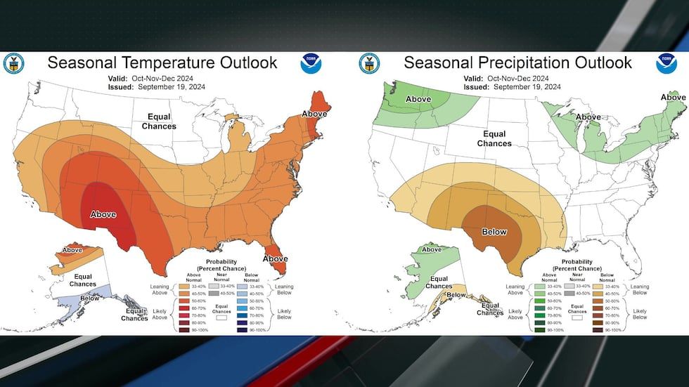
Closer to home in North Dakota, the seasonal outlook for the months of October, November and December is anticipating that we have very good odds to see near normal temperatures and precipitation.
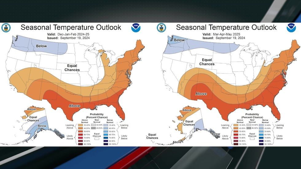
December through May are expected to have below normal temperatures in North Dakota.
December through March are expected to have above normal moisture in North Dakota.
Copyright 2024 KFYR. All rights reserved.