

Google Maps and Earth are getting major updates. These include sharper satellite images, wider Street View coverage and a new “time travel” feature.
Marcel Horzenek / t-online
More from “International”
An article from
Google has significantly overhauled its Maps and Earth mapping services. The company said in a blog post that users can now enjoy sharper satellite images, expanded Street View features and historical shots.
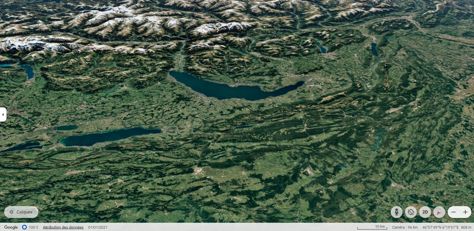
The core of the update is the introduction of the “Cloud Score+” artificial intelligence (AI) model. This has been trained using millions of images and is now capable of removing clouds, haze and fog from satellite images. Natural weather phenomena like snow or mountain shadows are retained, allowing for a more realistic and clearer representation.
Part of Switzerland and the Alps on Google Earth.
Virtual walks in more countries
One of the biggest improvements is Street View. Google has updated existing shots in around 80 countries and also added new regions. Thus, users can now take virtual walks in cities in Bosnia, Namibia, Paraguay or in the Principality of Liechtenstein.
To facilitate the capture of additional areas, the company is relying on a newly developed camera specially designed for its mapping service. Weighing only seven kilograms, it should make it possible to take street views even in areas that are difficult to access. The goal is to keep the digital map up to date and visualize changes in real time.
Street view taken from Disappointment Bay in Tasmania.
A look at the past
The Google Earth update is particularly exciting for history buffs and environmental researchers. The service has been enriched with historical images that go back up to 80 years in the past. Users can thus follow the evolution of landscapes and cities over several decades.
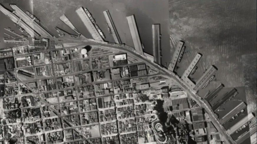
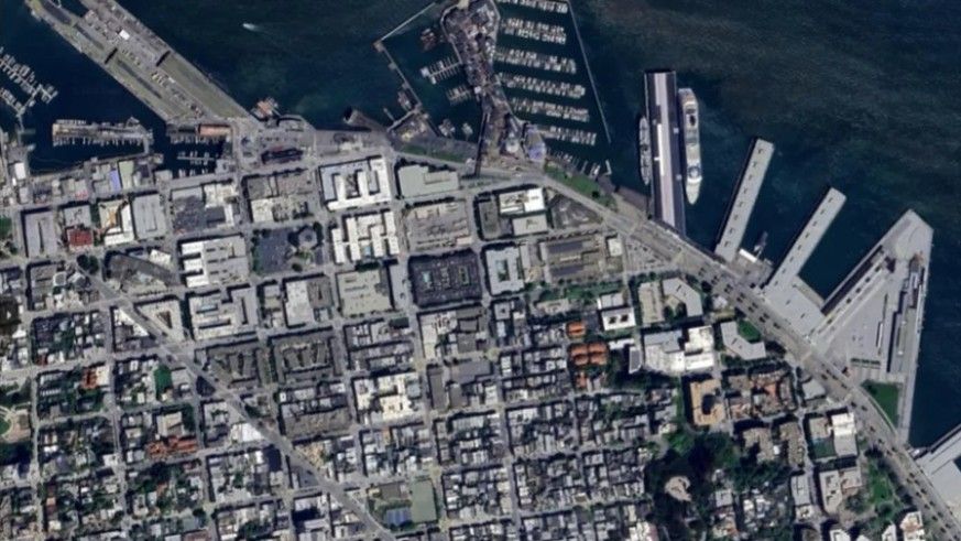
San Francisco in 1938 (left) and 2024: the new “time travel” function on Google Earth.google
In one example, Google shows a black and white photo of San Francisco from 1938. Comparison with current images clearly shows how the use of port facilities has evolved from industrial use to tourist attractions. This “time travel” function also makes it possible to make long-term developments such as climate change or the effects of war visible.
The improvements go beyond just image quality, however. Google points out that the updates have also improved the accuracy and accessibility of the services. By combining Street View and aerial views in the new “Immersive View”, users can now explore cities and routes in higher detail and in 3D.
International news, day and night, is here:
Show all articles
Translated and adapted from German by Léa Krejci
The Kremlin wants to offer the inhabitants of the conquered territories cities where life is good. Russian agencies therefore recruit thousands of workers, lured by false promises. Explanations.
Vladimir Putin faces a series of problems that he himself created with the invasion of Ukraine two and a half years ago. Western sanctions are penalizing the Russian economy, embargoes are causing material shortages and public support for the brutal attack on its neighbor is dwindling.


