The often calm autumn weather of late ends this week. Indeed, the meteorological situation has fundamentally changed and, during the week, several disturbances, accompanied by westerly winds at altitude, will cause unstable, temporarily windy weather and, from the middle of the week, a cold, wintry weather with snow showers down to low altitudes. In particular, a disturbance overnight from Tuesday to Wednesday will bring heavy precipitation and strong to stormy winds. Another disturbance should also bring the first snow to the plains during the day on Thursday.
Tuesday warm front, night from Tuesday to Wednesday cold front
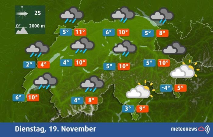
Tomorrow Tuesday, Switzerland will enter the zone of influence of the stormy depression Quiteriawhich will move during the day from the south of England to the Baltic Sea via the Benelux and the north of Germany. This brings a warm front towards the Alpine space during the day and a front froid during the night from Tuesday to Wednesday. The weather will therefore be very cloudy and humid in the north, with snow from 1500 meters above sea level. Additionally, a southwest wind stronger and stronger winds will blow in the plains with gusts of 60 to 80 km/h, and a little foehn will blow temporarily in the Alpine valleys. Thanks to the latter, the weather will often remain dry until the evening in Graubünden. Temperatures then rise to around 10 degrees. In the south, the weather remains dry with similar maxima and sometimes a little sunshine, particularly in southern Ticino (see ill. 2).
Fig. 1: Weather tomorrow Tuesday; Source: MeteoNews
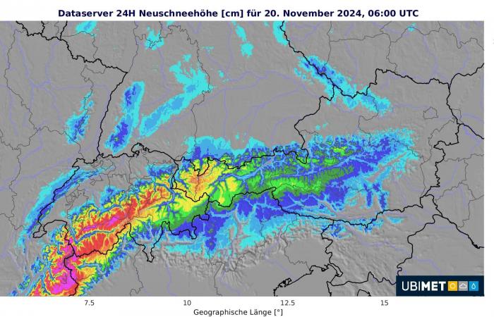
During the night from Tuesday to Wednesday, the front froid of the stormy depression mentioned above will pass with fanfare! There will therefore be sometimes heavy rain et strong to stormy winds from the southwest to west with gusts of around 70 to 100 km/h in the plains and in the Alpine valleys, or even a little more in places at altitude. On the summits and heights of the Jura, you must sometimes expect hurricane gusts (> 118 km/h), which can locally reach nearly 140 or 150 km/h. Furthermore, the snowfall limit will sink at lower altitudes, but drier air will arrive at the same time. So, in the plains, on Wednesday morning, there should be at most a dusting in places, and in many places, there should be no snow. In the mountains, the fresh snow will be abundantwith more than half a meter expected in the Alps (see figure 3).
Fig. 2: Amount of snow from Tuesday morning to Wednesday morning; Source: MeteoNews, UBIMET
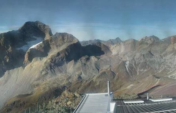
However, this snow will be heavily blown by stormy winds. However, winter sports resorts will be particularly happy with this welcome snow, because currently, in the Engadine for example, there is no snow up to more than 3000 meters (see figure 4)!
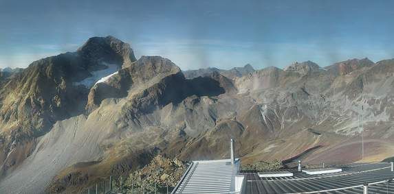
Fig. 3: Currently, for example, there is snow in the Engadine up to over 3000 meters (Piz Nair 3050 m).; Source: Pano Cloud Piz Nair
Wednesday: April weather
Wednesday, typical April weather settles behind the cold front in the area of cold air at altitude . There will therefore be sunny periods in fairly windy weather, but also some snow showers or sleet. Of the lightning and thunder are also not excluded locally. During sunny periods, temperatures reach around 5 degrees. In the south, the weather is dry and sunny with a northern foehn and milder temperatures of 11 degrees.
Thursday, first snow likely in the plains
On Thursday, a depression will pass to the south of our country, bringing numerous clouds and increasing precipitation. With a little kiss, he should snow until plain, with only 1 to 3 degrees. THE quantities exact of fresh snow are not yet known, and it is possible that the far north (northwest of Switzerland and Schaffhausen) will be spared by snow. Otherwise, there will probably be one or two centimeters of new snow, especially as we move west and towards the Alps. It is in Valais that we can expect the greatest amount of new snow, with more than half a meter possible in the mountains. In the south, it will also be cloudy and temporarily humid, with snow or rain at lower altitudes, depending on the weather model.
Friday, wintery cold, but at most a few snow showers
On Friday we will be in the area again of cold air at altitudeso the time will be variable and cold in the north, with temperatures barely above 0 degrees, but at most a few snow showers are expected. In the south, on the other hand, the northern sector foehn will bring us fairly sunny and milder weather than in the north.
Weekend: a clear softening
The weekend will bring variable and generally dry weather, first in the mountains, then Sunday in the plains, with a clear warm. Additionally, a foehn more and more stormy rises on Saturday in the Alpine valleys. Thus, thezero degree isothermal will rise above 2500 meters by Sunday. In the plains, it will be significantly milder on Sunday, with temperatures around 10 degrees. In the Alpine valleys, the foehn can reach 15 degrees. Thus, the snow at low altitudes is already disappearing and the arrival of winter on the plains is once again a thing of the past.
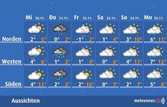
To finish here is an overview of the evolution of weather and temperatures between Wednesday and next Monday (see ill. 5).

Fig. 4: Evolution of weather and temperatures from Wednesday to Monday; Source: MeteoNews

