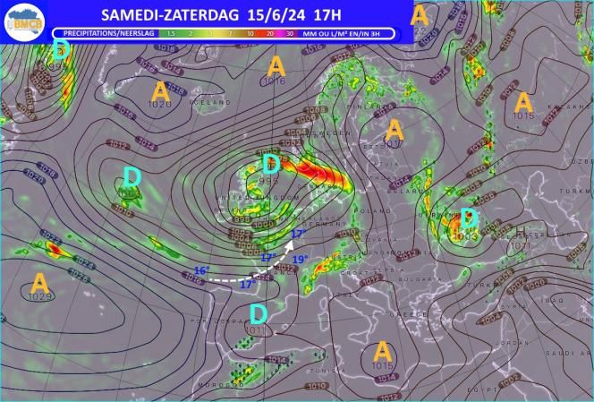


The atmospheric conditions will be determined by a depression which arrived in Scotland on Friday and which organized an unstable and cool southwesterly current coming from the Bay of Biscay. This Saturday this will give us a sky that will initially be quite clear but which will gradually become cloudier from the sea with, around midday, rain near the French border spreading in the afternoon towards the center and north of the country.
videos
However, clearings should persist in the center and north of the Ardennes region as well as on the coast where there will be few or no showers.
It will still be quite cool for the season with maximums between 14 and 17° in the Ardennes and 17 to 19° in the other regions. The southwest wind will be strong with peaks of 30-50 km/h.
Temporary and sometimes heavy showers will persist the following night with minimums of 9° to 14° depending on altitude.
On Sunday we should find the same type of very unstable weather with some temporary clearings and showers which should appear especially in the northwest and southeast half of the country.
Temperatures will not change and will therefore remain 2 to 3° below normal for mid-June.
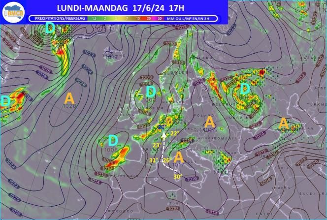
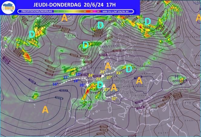
Monday
The arrival of an active and stormy warm front over the country will cause very cloudy skies with rain becoming increasingly heavy in the afternoon, especially in the center and south-east of the country.
Thunderstorms may break out during the heaviest precipitation.
Despite the rain it will be less and less cool with temperatures reaching or exceeding locally the 20° mark in the plains.
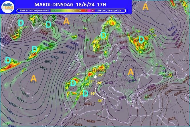
It will rain less and less the following night which promises to be mild with temperatures not falling below 13 to 14° in the Ardennes and 15 to 16° in the plains. Tuesday The warm air present over the center and east of France will try to rise more and more towards the Benelux but will come into conflict with the cool air still very present over the North Sea which will cause a new wave of rain significant sometimes accompanied by thunderstorms from the south of the country.
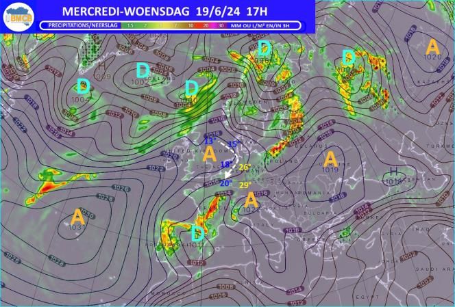
It will still be very mild or even quite hot with maximums of 17° along the sea but up to 23 or 24° in any clearings which could appear in the afternoon in the south and east of the country. Wednesday With the arrival of an anticyclonic ridge over England and the North Sea, the wind will veer further north which will put us in fresher but stable maritime air again with a lot of morning gray but also developments of cleared during the afternoon.
Maximums generally returning between 17 and 22°. Evolution for the rest of the week The weather will remain very mixed with periods of clearing but also daily rain or showers with seasonal temperatures oscillating in the afternoon between 16 and 19° in the Ardennes and between 19 and 22° in the plains. the heaviest rains should mainly affect the eastern half of the country.
Probable trend for the weekend of 22-23 and the following week
Conditions should gradually become more stable and sunnier with a bonus in temperatures which would (finally) increase to 23 to 26° in the plains…


