Published on June 20, 2024 at 1:06 a.m.
Abitibi was hit by violent storms on Wednesday. Energy remains present, and the risk of storms will move towards the south of the province. Forecast.
A tree uprooted by the wind in Macamic
Photo: Valérie Verreault
Posts torn off
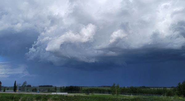
Western Abitibi was the scene of very strong gusts during the day on Wednesday. Poles were torn down, sometimes smashed, and thousands of customers were plunged into darkness. At one point, more than 75% of the entire population of the Abitibi-Ouest MRC was without electricity.

Energy to spare
The heat remains present over Quebec during the night from Wednesday to Thursday, so there is still ample energy available for the formation of storm cells. But this time, it is the south of the province that should be affected. Humidity remains very high in the south of the Quebec region, around the St. Lawrence valley. Outaouais Montreal, Montérégie, Basses-Laurentides, Lanaudière and Estrie will still see the air well filled with water vapor, therefore precipitable water.

Around the south
Thursday afternoon, the metropolitan region and Estrie will be the sectors most likely to see violent storms develop. It would therefore be possible to see heavy rain, powerful gusts and even small hailstones. The risk of thunderstorms will be present along the river from Montreal to Gaspésie and on the North Shore, but the intensity should be more modest.

SEE ALSO: A smoke monster in the southwest
#Canada


