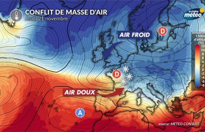
After two weeks of calm weather in the country, the situation changed at the start of the week with the return of depressions in France. Heavy rain, strong wind and snow at low altitudes are expected depending on the timeline of events.
We were no longer used to it in recent days: Atlantic disturbances are returning to our country this week, with a lot of agitation on the agenda. The Weather Channel allows you to follow day by day the risk periods for the various expected parameters, namely wind, heavy rain and snow.
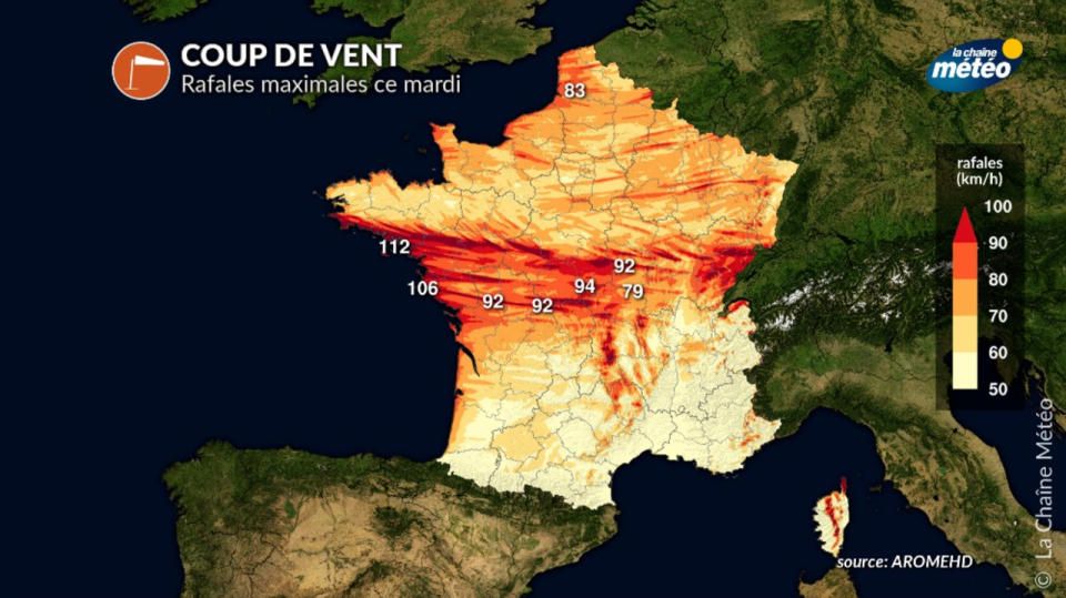
This Tuesday, very rough day in the north with heavy rain and wind
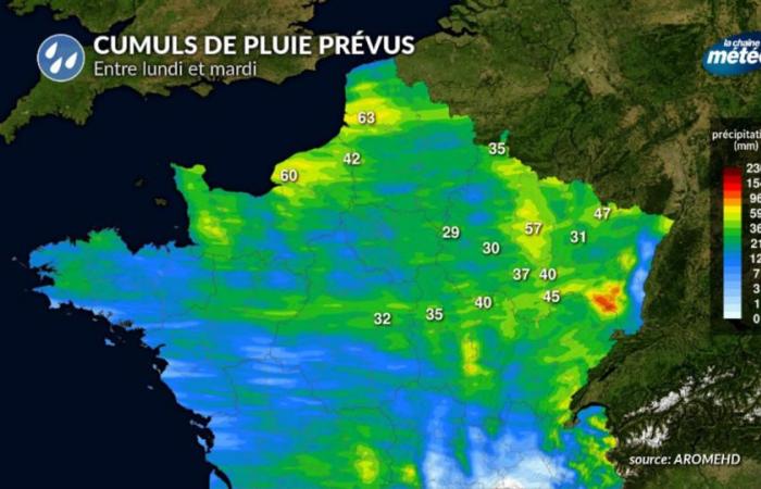
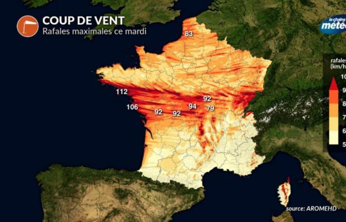
The disturbance from the day before will sweep the regions of the northern half all day with heavy rains which will extend along an axis stretching from the center-west to the north-east. As this active disturbance passes, the northwest winds will strengthen, reaching 90, even 100 km/h as far as the Vosges massif, in a turbulent atmosphere. As the flow passes to the northwest sector, temperatures will begin to drop and the disturbance will also affect the southern half, except the Mediterranean. Snow will fall in abundance in the second part of the day on all eastern reliefs, at lower and lower altitudes towards the end of the day.

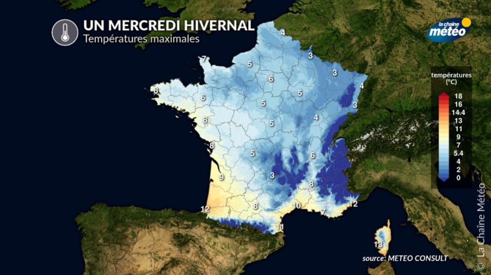
Wednesday, slight short-term respite from the cold
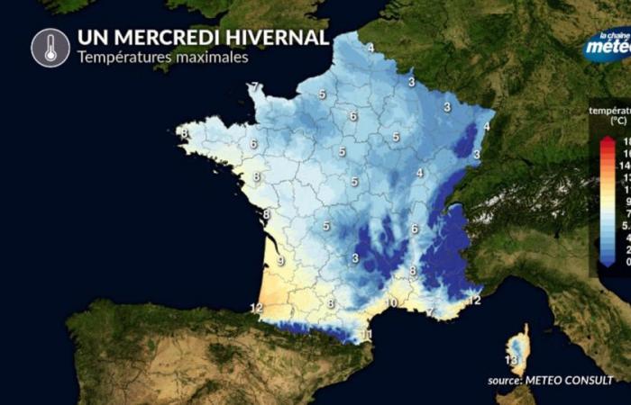
For Wednesday, France will be between two disturbances, with a temporary calm in most regions. However, the snow will continue to be abundant in the northern Alps and the wind will blow very strongly in the Mediterranean and Corsica, with gusts of around 80 km/h. It will be cold with highs at mid-winter level.

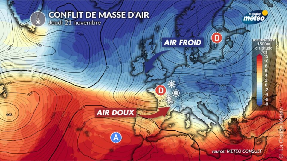
Thursday, possibly the busiest day
Thursday will be the highest risk day of the week. A hollow depression could cross France in its heart with a possible strong gale in its southern part, between the southwest and the northern Alps. In the northern part, there will be heavy rain which may occur with abundant snow at low altitude in the Vosges. Depending on the exact position of this depression, large shifts are possible, hence the reliability which becomes very limited at this time. By late Thursday, snow could gradually replace snow at increasingly lower elevations in the north.

Friday, risk of snow in the plains in the northeast
For this last day before the weekend, the situation could finally calm down after the depression passed the day before. However, the northwest flow could remain unstable behind with low temperatures. In this configuration, it is therefore possible that the snow showers will reach the level of the plain between Lorraine, Alsace and Rhône-Alpes in particular, even if for the moment, it is still too early to announce it. In Brittany, as a new disturbance approaches, the wind could strengthen again in Finistère.
It is therefore a very hectic week which concerns the country. Our entire team will be mobilized to follow the many events expected until next weekend.
Original article published on La Chaîne Météo

