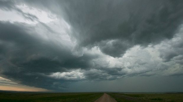
A tornado watch is in effect for several areas surrounding Toronto.
Environment Canada issued the alert Thursday morning, warning of wind gusts with speeds of up to 110 km/h.
Newmarket, Aurora, northern Durham Region, Peterborough, Caledon and Barrie are among the areas affected by the tornado watch.
“Conditions are favorable for the development of severe thunderstorms which may produce tornadoes,” the national weather agency wrote in the alert.
Heavy rain and nickel to Toonie-sized hail is also possible is some areas starting this afternoon.
Environment Canada called the situation dangerous and “potentially life-threatening,” warning members of the public to take cover if a tornado does form in their area.
Gerald Cheng is a meteorologist with Environment Canada and spoke with CP24 on Thursday. He said while the alert doesn’t guarantee a tornado will touch down in any of the affected areas, he said “the ingredients are lined up.”
“Right now, what we are concerned about is the timing between 2 pm to 8 pm All the conditions are aligned, so during that time if a thunderstorm develops, then there could be potential for [a tornado],” Cheng explained.
Cheng said his team is specifically tracking the north side of York Region. Once the weather system reaches Markham and Richmond Hill, he said, the tornado risk should subside, although the situation is very fluid.
“We know that a lot of people are doing outdoor activities. Just be careful when you are doing outdoor work or when you are outside. If the weather deteriorates, you need to seek shelter right away. Don’t wait for the weather alert,” he said.
A graphic from Environment and Climate Change Canada shows weather advisories including tornado watches on Thursday, June 13, 2024.
The alert was issued ahead of a windy afternoon in Toronto, where the risk of thunderstorms is also present, although no weather alerts have been issued for the city at this time.
“Today will be very warm and muggy with increasing clouds and the risk of local pm showers and late day/evening storms,” CP24 Meteorologist Bill Coulter said.
Wind gusts in Toronto started at approximately 1 pm and are expected to reach speeds of 50km/h. The wind will be joined by a risk of thunderstorms starting at 4 pm, which stretches well into Thursday night.
Lingering showers will continue to pass through the area overnight and produce a high of 24 C on Friday.
“A few isolated showers may pop up Friday. But, bright and pleasant weather is on the way for the start of the weekend,” Coulter said.
Saturday will bring mainly sunny skies with a breezy wind and a high of 24 C. Sunday’s Father’s Day forecast is expected to be cloudy with a risk of showers in the evening and a high of 24 C.
Things will really heat up on Monday, when the temperature could reach 31 C, but will feel like 37 with the humidity. The heat will continue through Tuesday and Wednesday when the highs are expected to reach 32 and 33 C, respectively.


