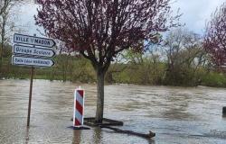
The rivers placed in the flood alert or pre-alert phase preventively on Wednesday morning remain so, continues the Cortex. “The pre-alert thresholds have not yet been reached but they will probably be reached quickly.”
Before arriving in Belgium, Storm Kirk is already causing damage (PHOTOS + VIDEOS)
The tributaries of the Haute Meuse and Basse Meuse, the Lhomme and tributaries, the Haute Lesse and tributaries, the Basse Lesse and tributaries, the Sûre and tributaries, the Moyenne Semois and tributaries, the Haute Semois and tributaries therefore remain in the alert phase. , the Chiers and tributaries, the Basse Semois and tributaries, the Vierre and tributaries, the Ourthe and tributaries, the Our and tributaries, the Amblève and tributaries, as well as the Vesdre and tributaries.
On pre-alert are the Mehaigne and tributaries, the Hoyoux and tributaries, the tributaries of the Middle Meuse upstream and the Haute Meuse upstream, the Eau Blanche and tributaries, the Eau Noire and tributaries, the Viroin and tributaries, the Dyle and tributaries, the Gette and tributaries, the Sennette and the Charleroi-Brussels Canal, the Senne and tributaries, as well as the Dendre and tributaries.
“For the moment, the quantities of rain do not cause other overflows,” specifies the Cortex. For the Ourthe and Amblève sub-basins, only light rain has fallen so far. The level increases, without overflowing, on the Semois, the Chiers and the Moselle, details the Cortex.
A hurricane in Belgium? Of course it’s possible!
The provinces of Namur, Luxembourg and Liège remain in code orange in the face of Kirk
The Kirk depression will still mainly cause continuous rain, and will cause very significant precipitation in the south-eastern half of the country between Wednesday morning and Thursday morning, recalls the Royal Meteorological Institute (IRM) on Wednesday evening. But part of this precipitation has already fallen south of the Sambre et Meuse furrow.
An orange warning is still in effect in the provinces of Namur, Luxembourg and Liège, where accumulations will range from 50 to 80 l/m2 in 24 hours, or very locally 90 to 100 l/m2, according to IRM forecasts. But the institute notes that some of this precipitation has already fallen.
A code yellow warning is issued for the provinces of Hainaut, Avers and Limburg, as well as Flemish and Walloon Brabant, where cumulative precipitation will reach 25 to 50 l/m2 in 24 hours in enough places.
The rainy front will gradually evacuate towards the east, then showers will follow from the west, as the night goes on, the institute further announces.


