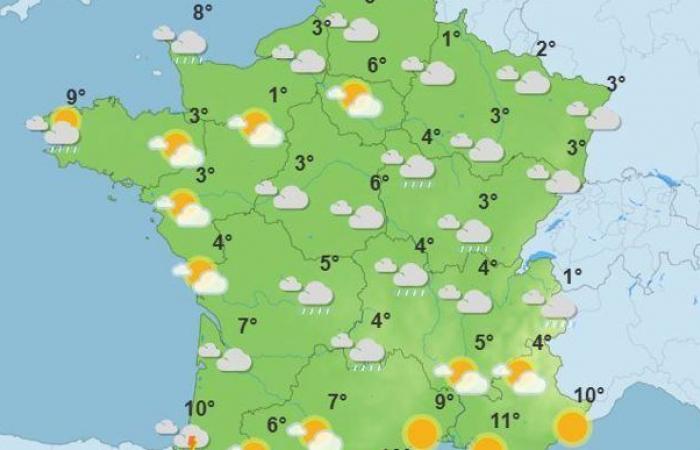
The calmer weather this week gives way to a drop in temperatures, most often below seasonal averages. This Friday, December 13, 2024 should be, on average across the country, the coldest day of the week, indicates Météo France in its latest bulletin.
Rainfall from Languedoc to the Massif Central
If temperatures rise slowly in the South-West and near the Mediterranean this Friday, they are falling in the northern half, with “almost widespread frosts from the Grand Est to the Center – Val de Loire and Auvergne-Rhône-Alpes, and more locally from Hauts-de-France to Brittany.”
The precipitation continues this Friday, shifting from Languedoc to the south of the Massif Central, sometimes with a stormy character. Snowfall is expected in the Massif Central above 1,000 meters above sea level.
The disturbance will then head east of the Rhône in the evening, lingering on Saturday between the Alps, the Côte d'Azur and Corsica, specifies Météo France.
Drop in temperatures on Saturday
A new influx of fresh air on Saturday December 14 will bring down temperatures, with numerous frosts in the North-East. Finally, during the night from Saturday to Sunday, the warm front of a disturbance will approach the Channel coasts. This rainy disturbance will mainly affect the northwest of the country during the day on Sunday, before moving towards the Grand Est the following night. Elsewhere, Sunday will not necessarily be sunnier, except around the Mediterranean, where the sky should be clear.
The start of next week will be marked by the return of strongly anticyclonic conditions. They should favor continued gray weather over the northern half, but more sunshine over the south, all with temperatures close to normal, says Météo France.
Clotilde de Gaillard


