Our maps indicate the return of disturbed weather in certain regions of France. Where will it rain? What are the expected rainfall amounts? Find our latest forecasts in this article.
If a large part of France is protected by the anticyclone, more depressed conditions concern the Mediterranean regions. Rain has already affected Corsica and Roussillon in recent hours.
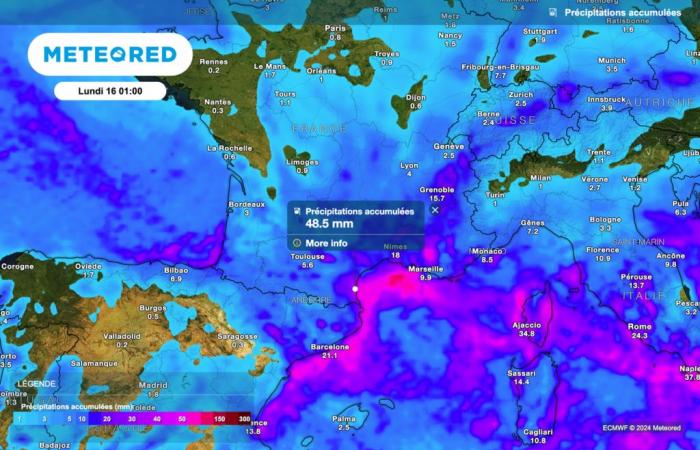
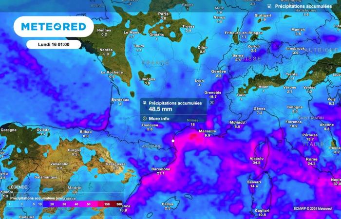
This instability in the Mediterranean will also gain more and more ground over the coming hours. Locally significant accumulations of rain are expected in Roussillon, with quantities that can exceed 50 liters per square meter.
Will the anticyclone eventually retreat? Will the rains gain ground? Which regions will be affected? Find our latest forecasts in this article.
Rainy weather in Roussillon
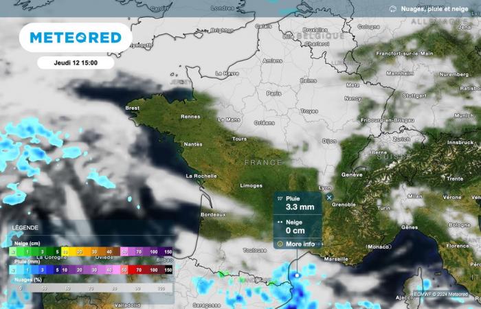
If dry weather will dominate a large part of France this Thursday, some rain is nevertheless expected in Roussillon.

After a very gray morning, marked by numerous fogs and low clouds, the map above confirms the return of beautiful clearing this afternoon between the Alps, Aquitaine and Brittany. The sun will also dominate the Vosges and the Jura.
On the other hand, low clouds should persist for a good part of the day between Normandy, Île-de-France, Hauts-de-France, the north-east and Lyonnais.
Cold temperatures
Temperatures will remain cold this afternoon, especially in regions where gray weather will persist. We expect 3°C in Dijon and Lyon, 4°C in Lille and Paris, 5°C in Le Mans and 6°C in Rennes. Milder temperatures are expected in the Mediterranean, with 13°C in Perpignan, 15°C in Marseille and 17°C in Ajaccio.
The rain is gaining ground tomorrow!
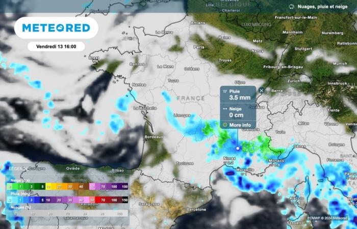
The rains will progress tomorrow towards the south-east of France. Sometimes sustained precipitation will once again affect Roussillon, where rainfall accumulations could locally exceed 50 liters per square meter. Good news nevertheless for this region, which suffers from a water deficit after several months of drought.

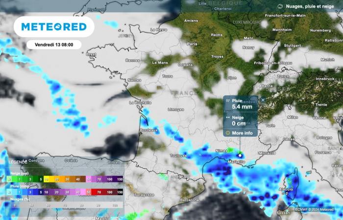
It is therefore rainy weather which should concern the entire Mediterranean region tomorrow, Friday December 13.

These rains present in the Mediterranean in the morning should progress towards the south-east of France throughout the day. Precipitation will also reach the Massif Central during the day. Furthermore, snowfall is expected in the Massif Central and the Southern Alps.
What changes during the day?
As the map below illustrates, Unsettled weather is expected to persist Friday afternoon.

If disturbed weather will affect a large part of the south of France, dry but not very sunny weather will dominate the north. Fog and low clouds are expected to persist for a good part of the day, with low light conditions and still cold temperatures.
This weekend
Often gray skies will dominate a large part of France on Saturday. Some precipitation may again affect the eastern regions, with a little snow on the Alps above 1400 meters.
The sun will dominate the Mediterranean regions on Sunday. Some nice sunny spells could also return along the Channel or near the Atlantic.

