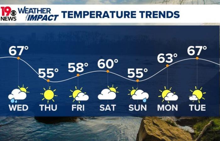
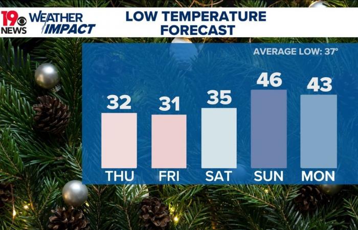
Temperatures are forecast to drop into the upper 20s to lower 30s Thursday morning.
COLUMBIA, S.C. — Heavy rain and scattered thunderstorms are expected this morning as a strong cold front makes its way through the area. Gusty winds will accompany the rainfall, especially as the front pushes eastward later today. Behind the front, breezy conditions will dominate, with gusts ranging between 30 and 40 mph into the evening.
A lake wind advisory has been issued, effective until early Thursday morning. After the rain clears, dry and cooler weather will continue tonight through Friday, followed by another increase in moisture over the weekend.
A deep upper trough over the Mississippi Valley is advancing eastward, pulling in a moist air mass. Observations indicate near-record levels of moisture in the region, with pockets of heavy rainfall already affecting the northwest.
Localized flooding remains a possibility, particularly north of I-20, but the advancing front is expected to accelerate and minimize the potential for prolonged heavy rain.
As the day progresses, the southeastern part of the region may experience marginally severe weather, with strong winds mixing down to the surface. Temperatures will begin to drop as the front passes, with the day’s highs likely occurring in the morning hours.
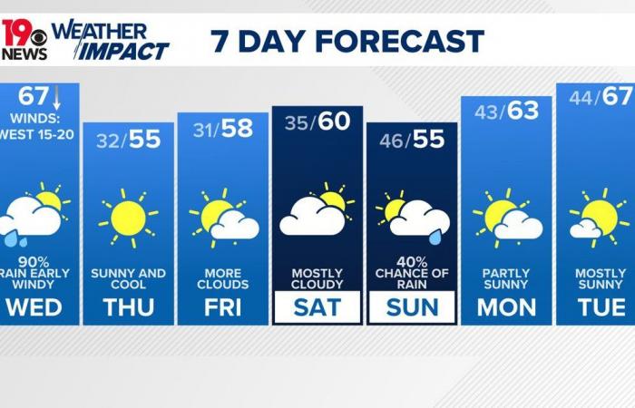
By Thursday, the weather will settle into a cooler and drier pattern. Under mostly sunny skies, daytime highs will struggle to reach the mid-50s, and overnight lows will dip into the upper 20s to lower 30s. Strong radiational cooling is expected due to clear skies and dry air, although slightly tempered by the positioning of a surface high pressure system to the north.
Friday will bring a mix of sunshine and increasing cloudiness as weak upper-level disturbances approach. While no rain is expected, cooler-than-average temperatures will persist, with highs in the lower to mid-50s. Overnight, increasing moisture will keep temperatures slightly warmer, ranging from the lower 30s in the northwest to the upper 30s in the southeast.

The weekend begins with a steady rise in atmospheric moisture as an upper trough approaches from the west. Rain chances will increase late Saturday into Sunday, with the highest likelihood of rain on Sunday as the trough moves through. With moist air and upper-level dynamics at play, the rain could be widespread, though temperatures will vary, ranging from the mid-50s in the western Midlands to the lower 60s in the eastern Midlands.

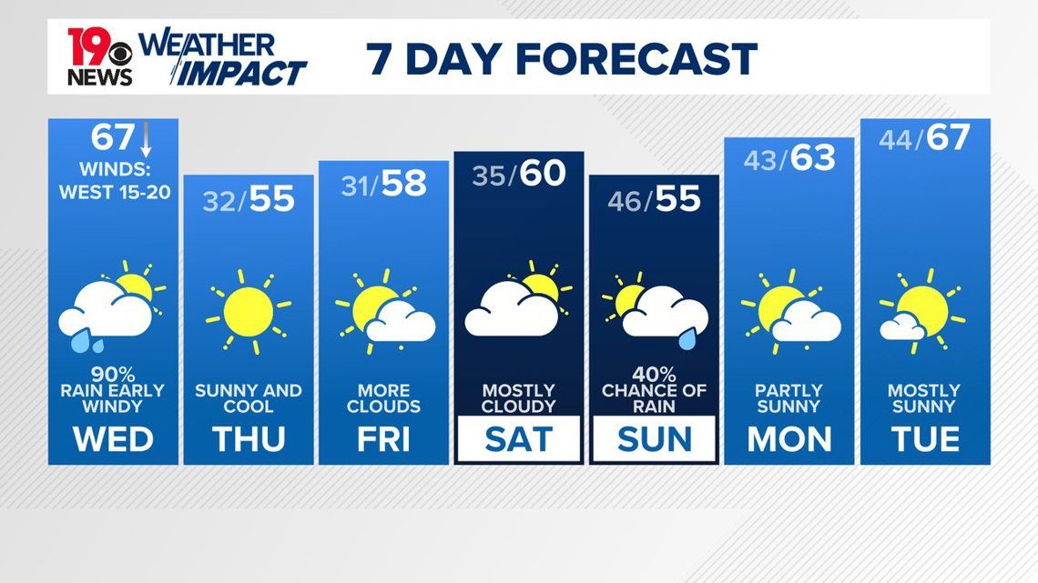
Looking ahead to early next week, the active weather pattern is expected to continue. Another upper trough will cross the area by Tuesday; some rain may be possible, but as of now, we are keeping the day dry. Temperatures should climb slightly as surface winds shift to a more southerly direction, allowing for some warming.
Morocco

