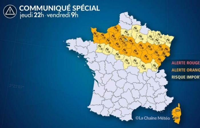
Of
Thursday November 21 at 10:00 p.m. au
Friday November 22 at 9:00 a.m.
Situation
The Caetano depression brings a storm to Corsica until Friday morning. Gusts reach more than 150 km/h in the mountains and on exposed capes. At the same time, after the exceptional snowy episode in the north, temperatures became negative and patches of ice formed from Normandy to the center-east, making traffic conditions very difficult in places, especially on secondary networks. Further snow showers are also expected in these regions. With negative temperatures, the snow will have no trouble staying on the ground.
Observation
At the end of the evening, snowfall gradually stopped in Franche-Comté, but temperatures became negative on snow-covered soils from Normandy to Burgundy with the formation of patches of ice.
Evolution
SNOW/ICE ALERT
Next night and early Friday morning
Snowfall stops or weakens in the departments on alert, but temperatures become negative with frosts between -1 and -5°C in general, particularly on snow-covered areas. Black ice will form quickly, particularly on the secondary network. At the end of the night and morning, further showers are expected. With negative temperatures, the snow will have no trouble staying on the ground.
WIND ALERT
Until Friday morning
The wind is falling in mainland France, while it is stormy in Corsica with gusts above 130-150 km/h in the mountains and the capes, even 180 km/h at the Corsican Cape.
France


