Tomorrow, Thursday, a low will move during the day from Brittany across the western Alpine region to the Balkan region. With an air mass limit, heavy snowfall can be expected over the course of the day, extending into the lowlands. Only in western Switzerland and Lower Valais is it likely to rain at low altitudes during the afternoon and in the first half of the night on Friday. Overall, there is a lot of fresh snow; in the German-speaking Swiss plains, even single-day fresh snow November records are possible locally.
First snow in the lowlands during Thursday
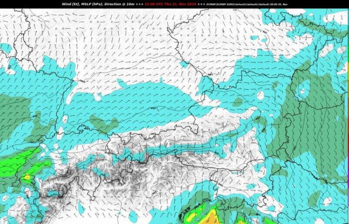
After it was only possible in places in the lowlands today first snow showers is enough, but it hardly starts, will move in tomorrow, Thursday Deep from Brittany eastwards across the western Alpine region to the Balkan region. Embedded in a strong western high current, our country lies in the area of one Air mass limitwhich runs from west to east over the course of Thursday heavy rainfall triggers. These first fall widely in the form of Snow to deep levels. In the evening and in the first half of the night, the core of the low lies almost exactly over western Switzerland, so that southwesterly winds can arise here for a short time and milder air can flow in (see Fig. 1).
Fig. 1: In the first half of the night on Friday there will be southwesterly winds in the west, while in the east there will be bise (European weather model ECMWF); Source: MeteoNews, UBIMET
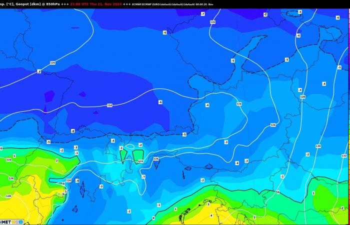
This increases the Snow line especially on Lake Geneva and in Chablais, temporarily rises to 1000 to 1500 meters, while in the east cold air remains near the ground with bise (see Fig. 2). This means it snows here all the time. The border between rain and snow runs pretty much exactly where the transition between southwest winds in the west and bise further east occurs. According to the European weather model, this is likely to be the case in the Bernese Mittelland area.
Fig. 2: Temperatures in the first half of the night on Friday at around 1200 to 1300 meters (European weather model ECMWF); Source: MeteoNews, UBIMET
However, the exact direction of movement of the low is not entirely clear; a north-south offset of just 100 kilometers has a major impact on how far the milder air can penetrate east. However, according to all weather models, it is clear that it is very… Snowing continuously in the north and eastern Switzerland and thus one Onset of winter gives.
Large amounts of fresh snow expected
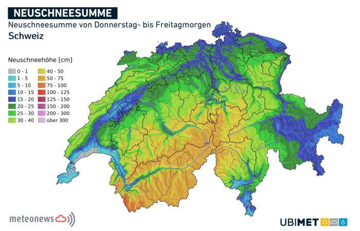
The mentioned direction of movement of the low with an air mass limit over Switzerland is a guarantee larger amounts of snowas a look into the past shows. Practically all record snow events in the lowlands were caused by comparable weather conditions. The prime example is March 5, 2006, when there was 53 centimeters of fresh snow in Zurich and 49 centimeters in Basel. Such extreme amounts of snow are not to be expected, but according to Fig. 3 they are in German-speaking Switzerland spread between 10 to over 20 centimeters of fresh snow inside.

Fig. 3: New snow total from Thursday to Friday morning; Source: MeteoNews, UBIMET
Where there is the most snow is modeled differently by the different models, but according to all available data, the new snow totals in German-speaking Switzerland are in the lowlands and in the Alpine valleys between about 5 and 30 centimeters. This must be spread at times snow-covered roads and thus difficult road conditions be calculated. On Friday mornings in particular, it is advisable to allow more time for your commute to work, especially if you are traveling by car. If you haven’t changed to winter tires yet (they actually still exist), you should definitely leave your car behind!
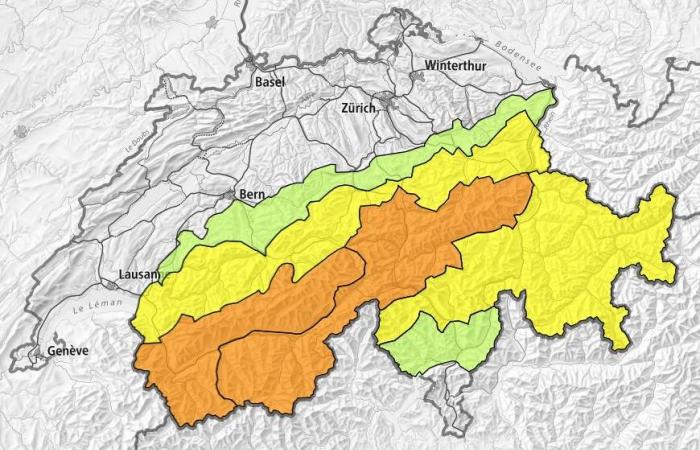
The amounts of fresh snow are even greater in the mountains, especially in the western Alps over half a meter of fresh snow to be expected. Together with all the snow from last night (see here) this is also the case Danger of avalanches an issue that is already significant, especially in the western and central Alps (level 3, see Fig. 4). With an increasingly stormy westerly wind on the higher mountains, larger snow drifts are to be expected again, so that the avalanche danger on Friday is likely to be at least level 3.
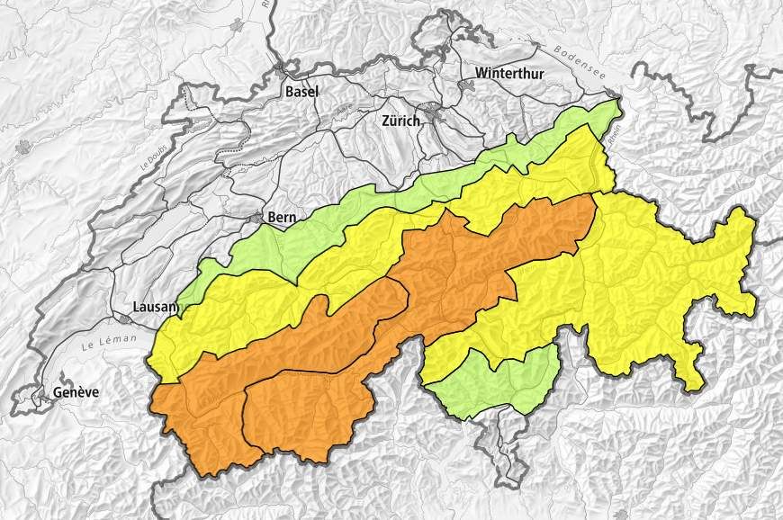
Fig. 4: The danger of avalanches in the Alps is already considerable in some cases (orange: level 3); Source: SLF
Increased risk of snow breakage at low altitudes
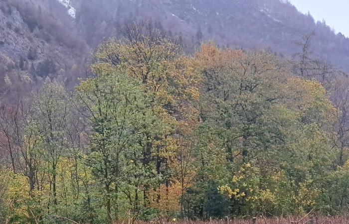
Since, as I said, larger amounts of fresh snow are to be expected and the falling snow is likely to be quite wet at low altitudes, this also exists here Danger of branches and trunks breaking. The trees have not yet gotten rid of all their leaves (see Fig. 5), which means that the snow can build up on the branches and, under certain circumstances, they can break under the weight. In some cases, entire trees could topple under the weight of the snow. In any case, it is advisable to exercise caution when walking in the freshly snow-covered forest on Friday.
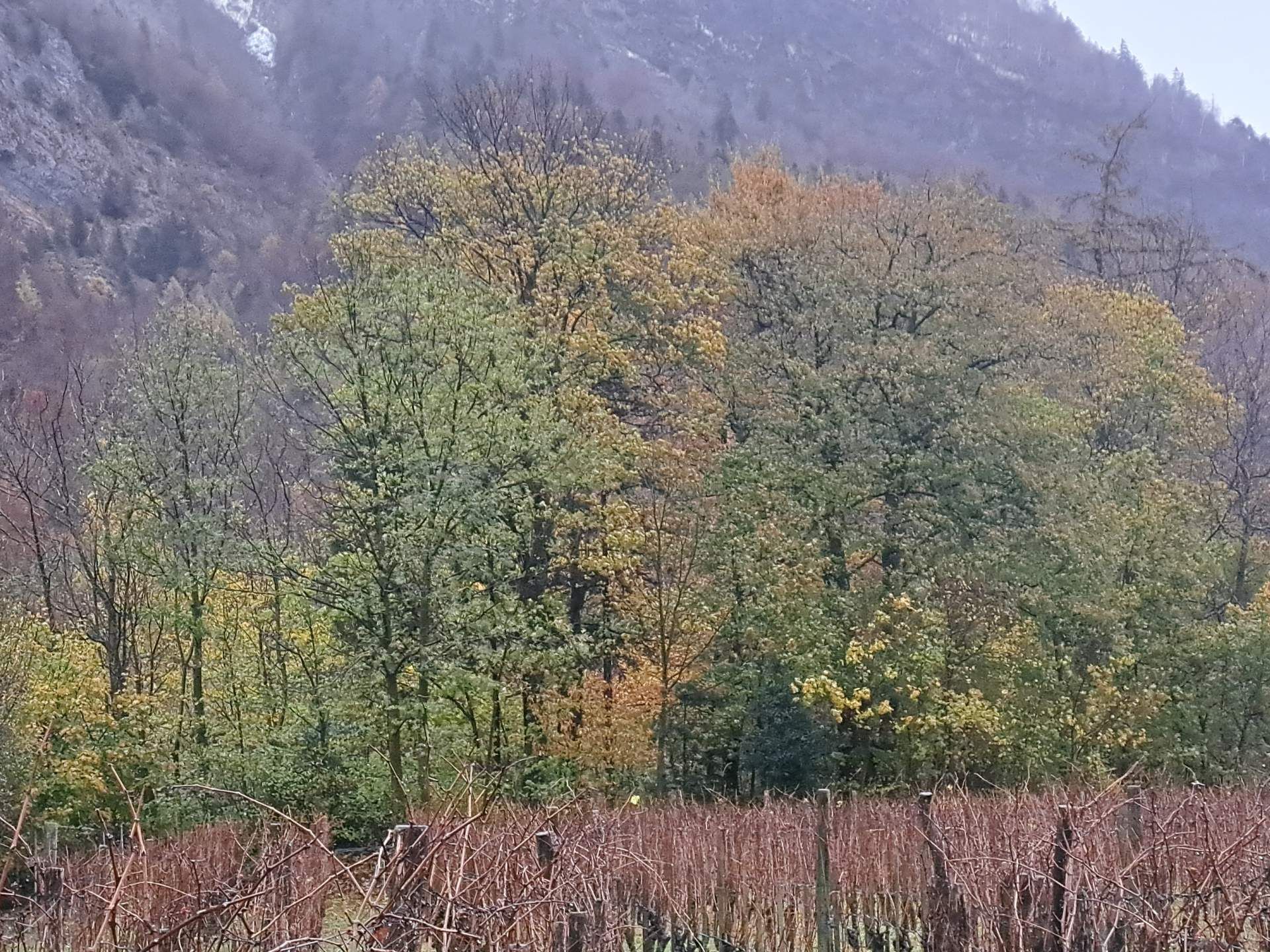
Fig. 5: Some of the trees still have a lot of leaves, which increases the risk of branches breaking with a lot of snow (picture from Sarganserland); Source: Roger Perret
New November snow records possible locally in the lowlands
The ones mentioned above Amounts of fresh snow within a day in the lowlands are exceptional for November, if not in places record-breaking high. Below are the previous records for the one-day amount of fresh snow for a few stations since the start of the respective measurements.
| Station | previous daily November fresh snow record | Data since |
| Basel | 14 centimeters (11/16/1952) | 1930 |
| Bern | 22 centimeters (11/27/1996) | 1897 |
| Zurich-Kloten | 17 centimeters (11/18/1999) | 1958 |
| Zürichberg | 25 centimeters (11/22/1990) | 1864 |
| Lucerne | 28 centimeters (11/16/1919) | 1883 |
| St. Gallen | 36 centimeters (11/22/1965) | 1938 |
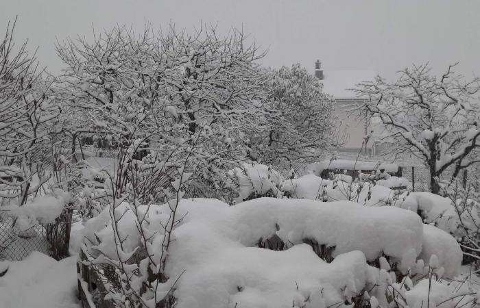
The following image proves that there can sometimes be large amounts of fresh snow at low altitudes in November (see Fig. 6).
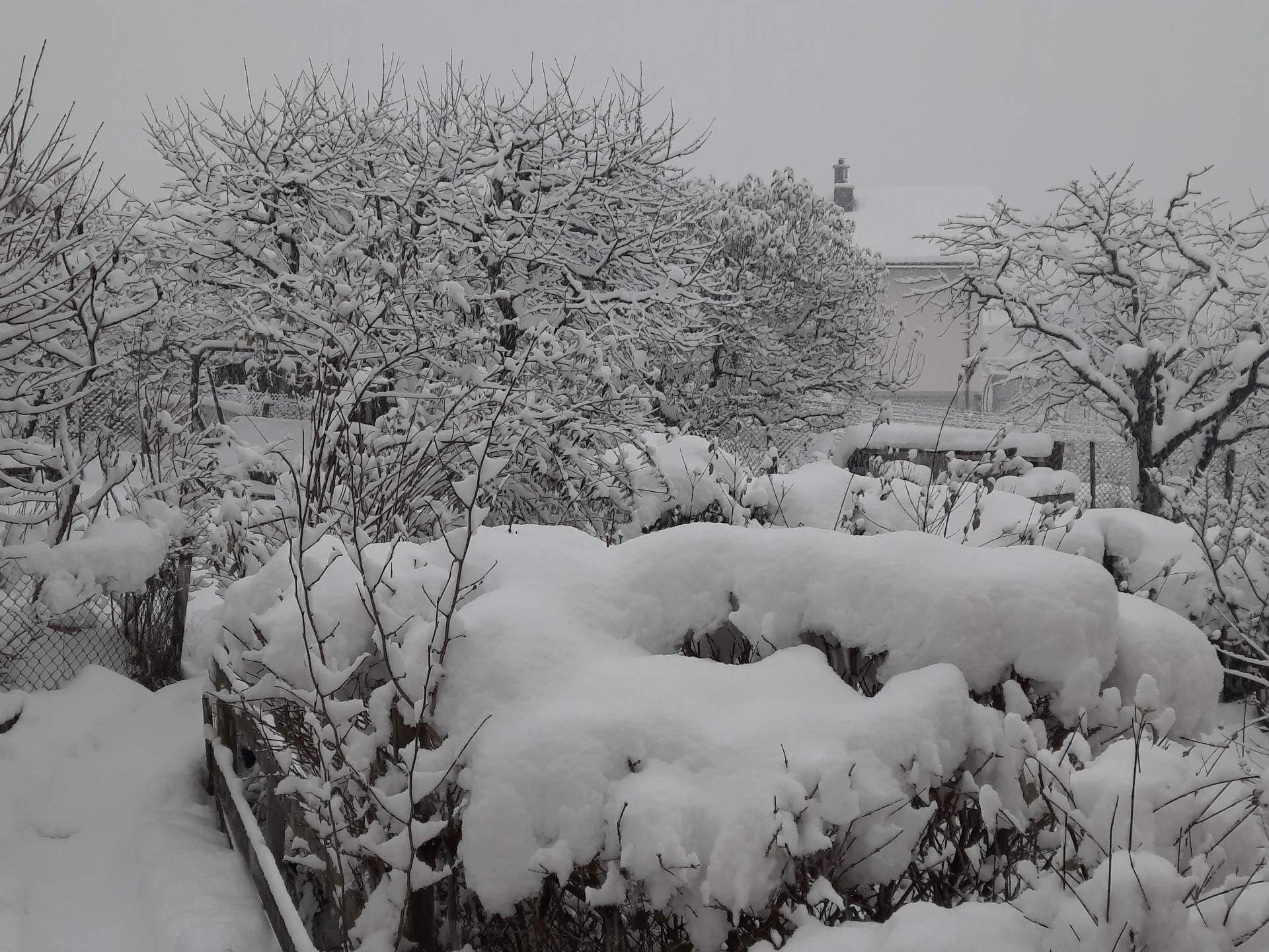
Fig. 6: “Chlapf” snow at the end of November 2021 in Sarganserland; Source: Roger Perret
Tomorrow there will be one at this point Blog about the first snowfall in the lowlands (e.g. earliest date, middle date).

