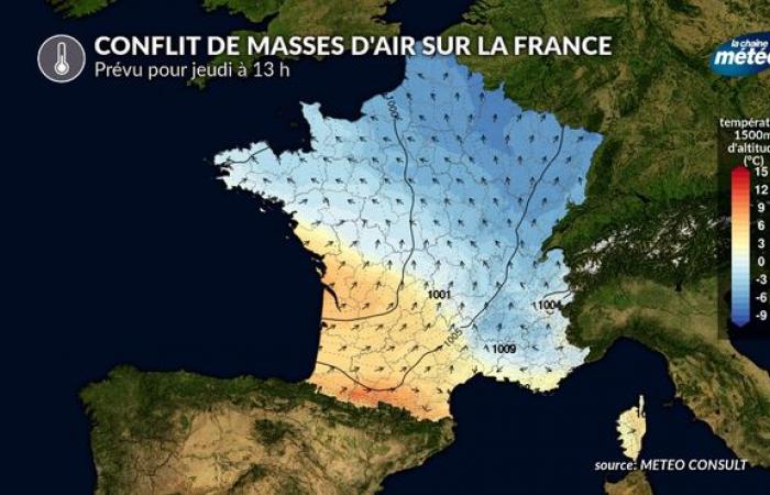
The meteorological context is strongly disturbed in France. Air of polar origin descends on our country from this Wednesday with a clear drop in temperatures. On Thursday, a new ocean disturbance will circulate across our country. Mild, moist air will collide with the cold air in place. This will cause a significant conflict of air masses with rain to the south and snow in contact with the cold air. Although this global scenario now seems certain, the transition zone between rain and snow still has a geographic margin of error of around a hundred kilometers. Likewise, snow depths and ground hold have not yet been determined.
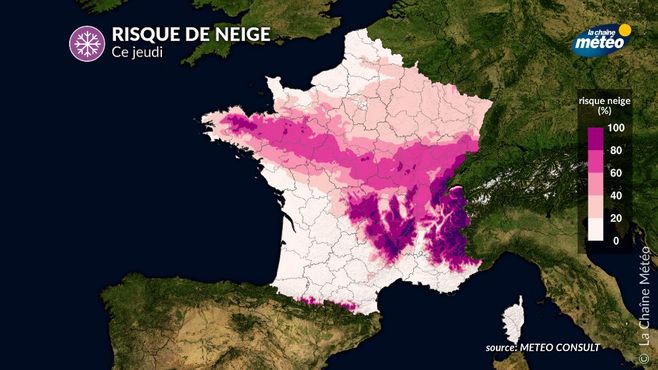
The disturbance will cut France in two on Thursday (rain in blue and snow in pink) © The Weather Channel
Air mass conflict over France scheduled for Thursday © The Weather Channel
A complex situation to anticipate
The digital models, which calculate your forecasts, had well anticipated since last week the risk of a “rainy-snowy” episode for Thursday. But since then, the models have varied a lot on the precise trajectory of this depression coming from the Atlantic, which is completely normal at distant timescales.
What becomes more complicated is that as the deadline approaches, strong uncertainties still persist. However, over the course of the numerical calculations (the “runs”), an overall scenario begins to emerge concerning the evolution of Thursday's disturbance. It is only this Wednesday that the final zoning can be proposed.
Snow in the plains of Brittany towards Franche-Comté and the Grand-Est

Risk of snow Thursday. Note: this map does not represent thicknesses. © The Weather Channel
The overall scenario is as follows: rain will arrive on Thursday at dawn over the Atlantic arc and will progress obliquely towards the axis of the Loire and the central-western regions. In the southern part of the disturbance, with the mild spell, it will rain, but upon contact with cold air in the north, the rain should turn into snow. It is this demarcation zone that will need to be further refined. Overall, this snowy axis should stretch from inland Brittany to the south of Normandy, towards Maine, Beauce, the Central region, the south of the Paris basin, before sliding towards the center-east during the afternoon. , on the edge of Franche-Comté and southern Alsace.
This limit could either go further north (according to certain models), or remain blocked at approximately the level of the Loire. This is what will need to be refined.
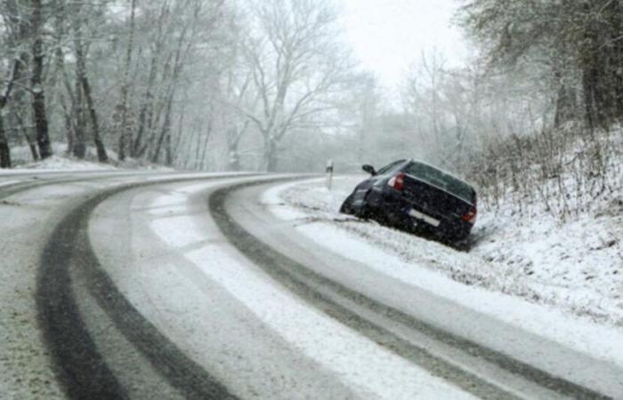
Once this scene is set, it will remain to determine the intensities of the snowfall and its hold on the ground. The hold on the ground will depend on the one hand on the temperature during the night (frost would allow the snow to hold easily), as well as on the temperature during the day. Between 0 and +3°C, the snow, more or less melting, can hold in the countryside and in hilly areas, which is clearly visible on our map. In this context, the snow would not last on the main roads or in the cities. The intensity of the snowfall will also have a noticeable effect: in the event of heavy snowfall, a layer may form on the ground (wet, sticky snow).
If this scenario is confirmed, an orange level alert will be issued to the departments concerned because traffic conditions would be altered.
We will then have to be wary of the refreezing of wet and snow-covered roads during the night from Thursday to Friday in these regions, because the cold air, still present in the north, will invade our country again after the passage of this rain-snow disturbance.


