Week dominated by low pressures
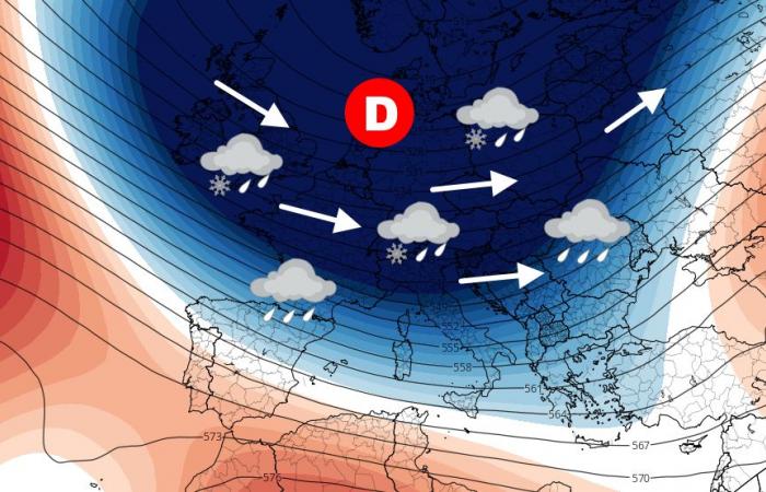
After three weeks of high pressure, depression conditions will make a comeback. A large low pressure anomaly is developing between Scandinavia, the North Sea and Central Europe. The ocean flow looks set to be very dynamic, then shifting to the northwest sector in France.
Geopotential anomaly from Monday November 18 to Friday November 22, 2024 – © wxcharts.com
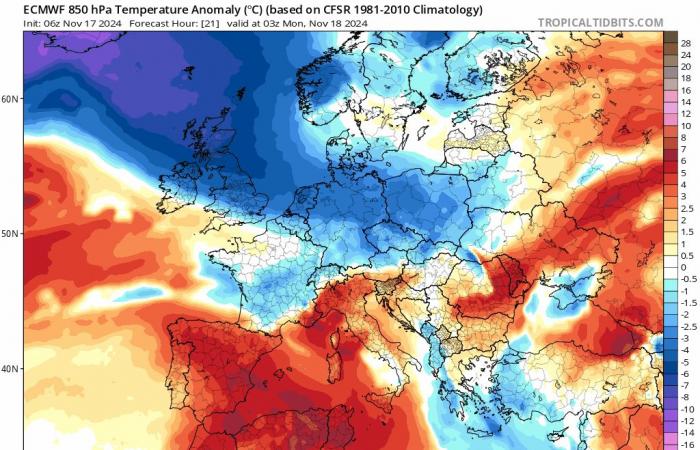
Thus, the relative mildness still present at the start of the week will give way to an intrusion of cold air, arriving from the north from Tuesday afternoon then moving towards the south from Wednesday. The middle of the week will mark a peak of freshness – not to say cold – with winter values. Then, a clear mild spell is expected over the next weekend.
Thermal anomaly of the air mass from Monday 18 to Saturday 23 November 2024 – © tropicaltidbits.com
Lots of excitement on the agenda
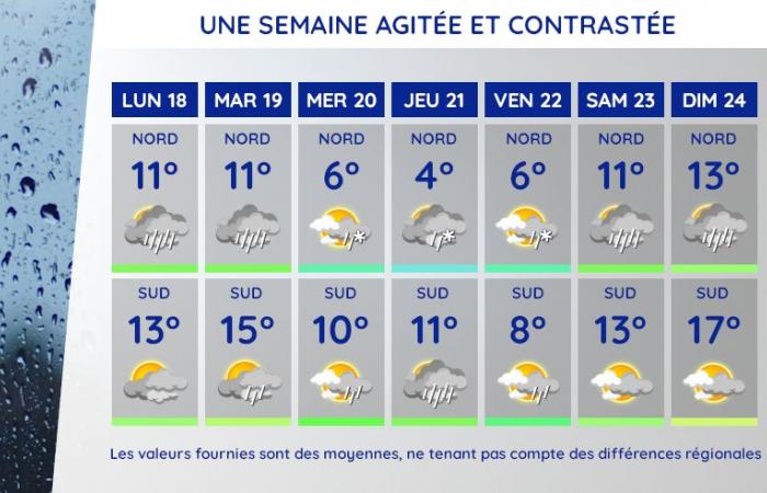
It will rain over the northern third from Monday then over the northern two-thirds of France on Tuesday, under a powerful wind and ocean air that is still quite mild. The drop in temperatures will be clear on Wednesday with a few showers in the north, center and east. Then, an active front is expected on Thursday. Associated with a deepening depression, it could bring snow to the plain in its northern part but the location remains very unclear. Then, a clear mild spell is forecast for the weekend with rain in the north but dry weather in the center and south.
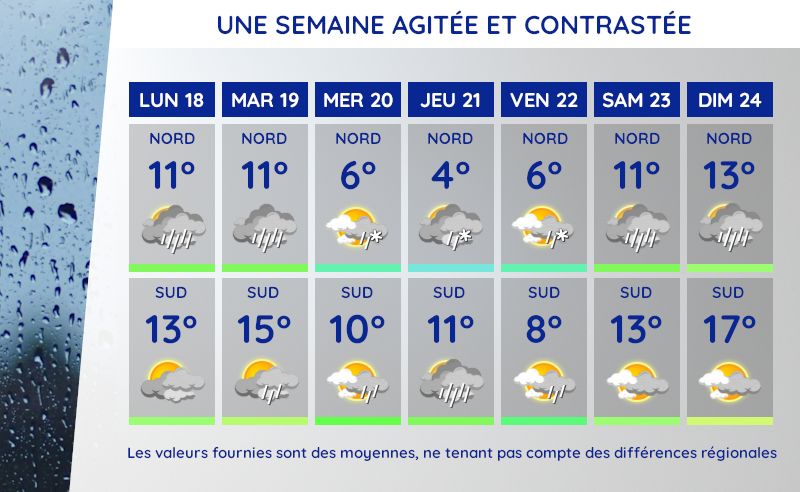
Weather and average temperatures from Monday 18 to Sunday 24 November 2024 – © Météo Express
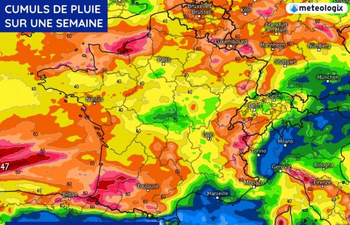
We must therefore expect copious precipitation over a large part of the territory during the week. As shown in the map below, almost all regions will be entitled to significant accumulations, particularly the eastern reliefs, the northern regions and the southwest. In the mountains, significant amounts of snow are expected.
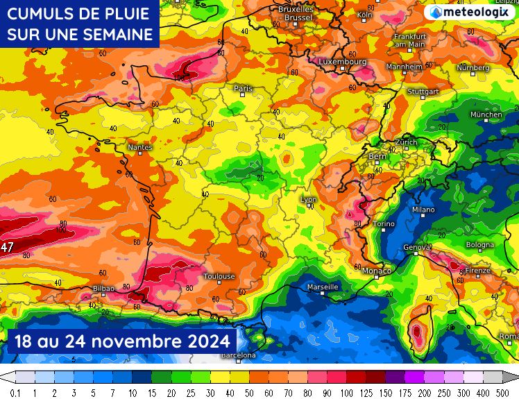
Rainfall totals from Monday 18 to Sunday 24 November 2024 – © ECMWF
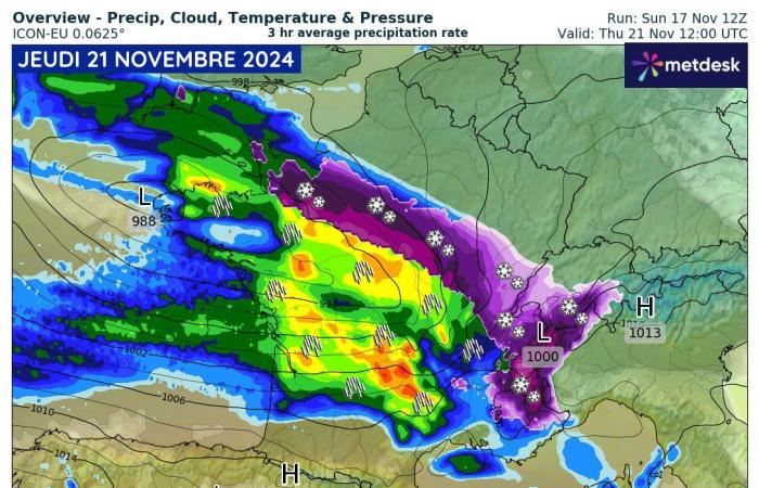
Risk of snow to watch for Thursday
During the day of Thursday, November 21, a low pressure minimum should pass over France, causing a very active disturbance. In its northern part, in contact with cold air, there is a real risk of snow on the plains. However, the location of the depression remains unclear and the scenarios diverge. Some see an axis of snow between Normandy and Franche-Comté, others rather in Auvergne-Rhône-Alpes… You will have to follow the next updates to find out more.
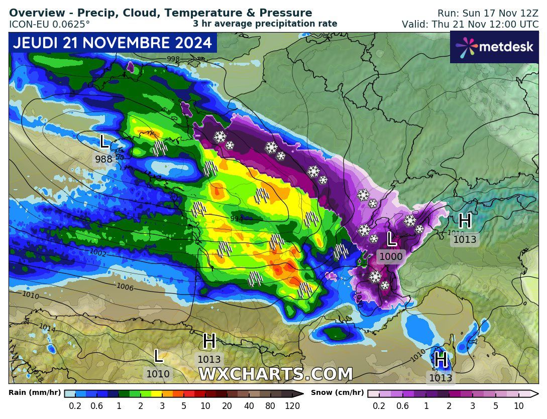
Type of precipitation during the day of Thursday, November 21, 2024 – © wxcharts.com
Do not hesitate to consult our 10-day forecast for more information on the weather in your region.

