In recent days, numerous publications on the internet have announced the arrival of winter weather with terms that are each more inaccurate and exaggerated than the last. We take stock of what will really happen over the next 10 days…
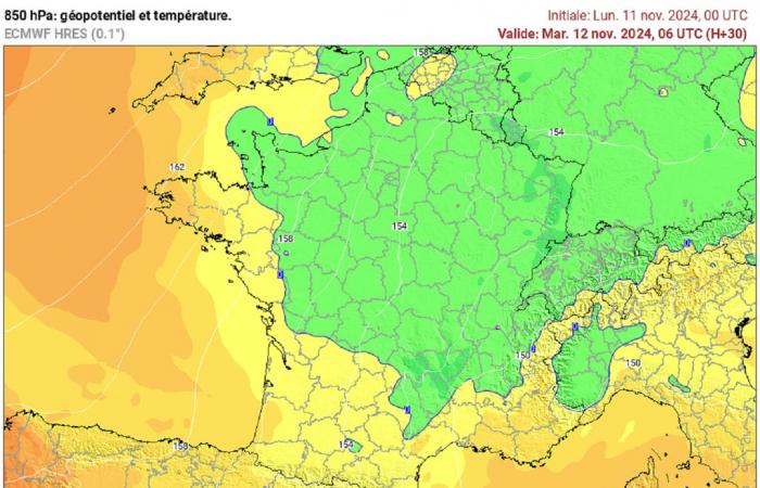
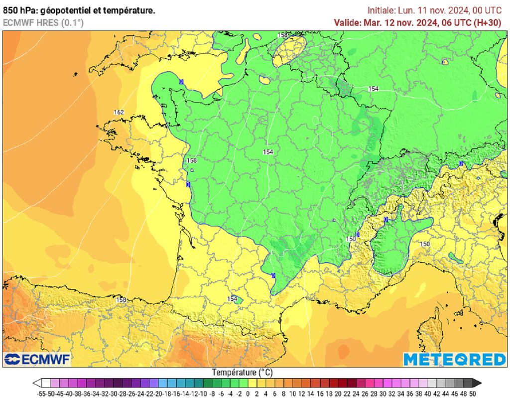
If the last few days have been marked by gray weather, particularly in a very large northern half, it was not particularly cold with the mercury often above seasonal norms. Over the next few days, the situation will evolve with a flow moving towards the north-northeast sector. Between a cold drop circulating in the east and south of the country and an anticyclone present on the British Isles, colder air will rush in and become more widespread over the next few days.
Is this the arrival of winter? Will polar air come to France? Is a cold snap brewing? If we ask ourselves these questions, it is because many articles distort the weather forecasts for the next two weeks for the benefit of the buzz… It’s time to set the record straight !
1st snow in the mountains, frosts at the end of the week
What awaits us this week is nothing exceptional or new: with a wind orienting to the north-northeast, cooler or even colder air will rush in and become widespread across the country by mid-week. Therefore, the precipitation expected this Tuesday will occur in the form of snow in the mountains. The first snowflakes of the season will fall on the Vosges and Jura ridges. The quantities will be greater on the other massifs with a few centimeters expected on the Massif Central, between 5 and 10 cm on the Pyrenees and up to 15 cm for the Southern Alps.
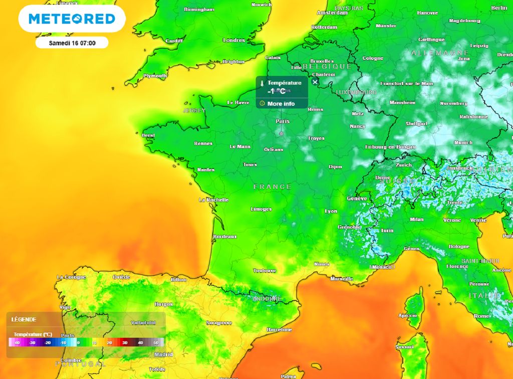
At the same time, the freshness will become widespread and accentuated with minimums most often in single digits from this Tuesday while in the afternoon, the maximums will hardly exceed the 10°C mark. Then, on Wednesday, thermometers will show between -1 and 4°C when you wake up in most regions. Small frosts are therefore expected between the Grand Est and Auvergne-Rhône-Alpes. During the day, don’t expect more than 7-8°C in these same regions.
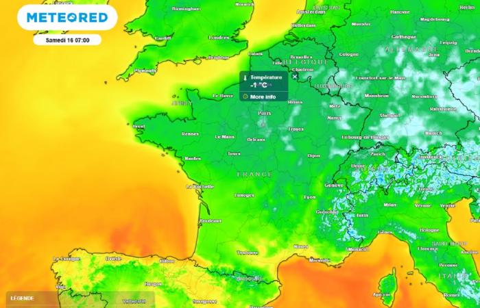
At the end of the week, temperatures will drop a few more degreesespecially for minimum values. This is explained by nights which will be clearer. The frosts will thus multiply and spread. Friday like Saturday morning, it will be between -3 and 0°C in the center-east and often between 2 and 4°C elsewhere.
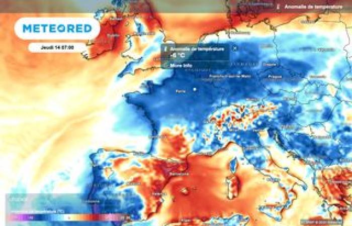
While the mercury will not reach remarkably low levels, This is the first breath of fresh air in November. It is the feeling which could be deceptive because with the expected sensitive windthe feeling of freshness or cold will be accentuated while temperatures will “only” be located between 2 and 4°C below seasonal norms.
Very uncertain weather developments next week
Weather conditions could become more abnormal later. Indeed, the different forecast models seem to be heading towards a descent of polar air for next week. According to some of them, temperatures could be well below normal this time while humidity could appear, producing snow up to low altitudes.
But let’s not get carried away ! Indeed, the still distant deadline invites caution by default. In addition, there are still significant divergences between the different models, resulting in numerous uncertainties and therefore very limited reliability. Those already announcing polar air or an early cold snap for next week are not serious…
So you have been warned! The most prudent thing is therefore towait for patterns to stabilize to offer us a reliable forecast within a few days and which we will not fail to provide you with details very soon!


