Since October 28, high pressure has returned to our country, bringing lasting calm and dry weather, which has not happened for more than a year.
The last ten wettest months since records began
The last ten months are the wettest in France since the beginning of the surveys. From January 1 to October 31, the average accumulation was 797 mm, or 182 mm more than normal. This therefore corresponds to a surplus of 30% for this period. In reality, a real rupture occurred from mid-October 2023, where, after a year of drought, Atlantic depressions again affected France. The very heavy rains caused in particular severe flooding in November 2023 in Pas-de-Calaisaffecting more than 500,000 people. The spring of 2024 was then particularly wet and, more recently, this start of October was exceptionally rainy. The month of October ended with 41% more rainfall than normal and 16% less sunshine.
Review of the month of October 2024 © The Weather Channel
Finally a lasting return of the anticyclone
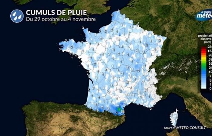
Rainfall totals from October 29 to November 4 © The Weather Channel
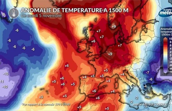
Since October 28, a little over a week, the weather pattern has finally changed. An anticyclone has positioned itself between the British Isles and Central Europe, favoring the return of calm and mostly dry weather. This situation has not occurred in over a year, which makes this 8 day period notable. However, anticyclonic conditions in autumn do not necessarily mean sunshine. With all the humidity accumulated in the lower layer in recent months, fogs and low clouds are frequent, particularly over the northern half as well as in the plains and valleys. In the mountains and in the south of the country, you enjoy beautiful sunshine and mild weather. In fact, the temperature of the air mass is particularly high for the season, around ten degrees, or 5 degrees above the average. We thus observe many thermal inversions, with freshness in the low points (valleys, plains) and great mildness day and night in the mountains.
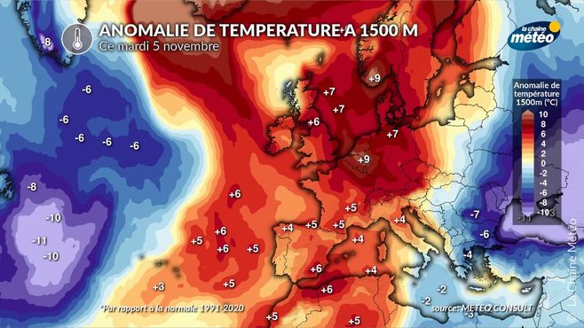
Temperature anomalies at 1500 m © The Weather Channel
Could this calm period be lasting?
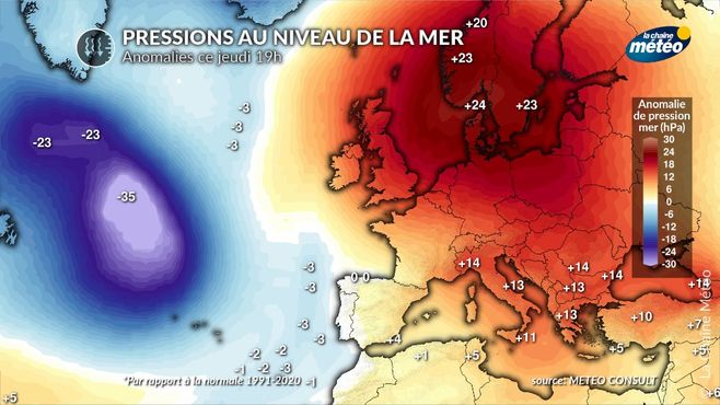
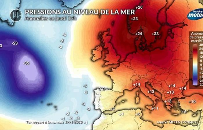
Sea level pressure anomalies © The Weather Channel
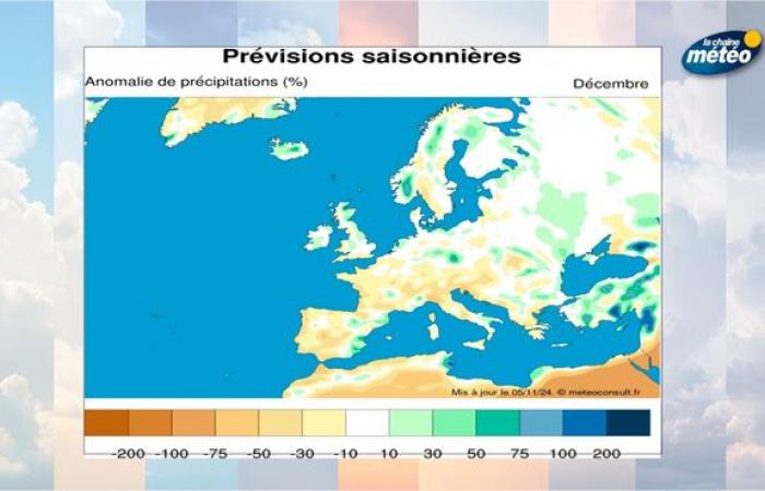
This week of calm and dry weather seems set to last. High pressures do not seem ready to leave Western Europe. Pressure anomalies reach up to +25 hPa over Scandinavia this week. Next week, high pressures are expected to shift towards the British Isles with an anomaly of +30 hPa, still guaranteeing dry weather in France. In addition, the northeast flow that will develop will not favor fog like this week. The sun should therefore be much more present, especially in the northern half. To the south, however, you will have to be wary of some unstable rises, with showers possible at the end of next week, especially near the Mediterranean. The dry and calm weather seems set to last with good forecast reliability for at least the next 15 days. Beyond that, our latest seasonal forecast are also considering a dry anomaly for the month of December, with continued high pressures in Western Europe.
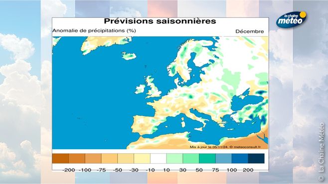
Precipitation anomalies © The Weather Channel
This long dry period would break sharply with the wet trend of the past year. If this is good news for the agricultural sector, it would on the other hand be bad news for our mountains a few weeks before the opening of the winter sports resorts.


