


Google’s tool now allows you to take a leap in time, looking from the sky at what your city looked like 20, 40 and sometimes 80 years ago!
At the end of September 2024, Google announced a major update allowing its Google Earth satellite imaging tool to travel into the past… showing what the Earth looked like from the sky 80 years ago. The ability to see how your city has evolved over the decades.
We took a look at Aveyron of the past. Already to note that the satellite images of Google Earth only go back to the year 1985 in the department, when certain large cities like Paris have aerial archives which go back to 1943. But also to realize that the satellite images which date of the 80s do not allow you to zoom in with as much precision as today, you have to squint to see anything.
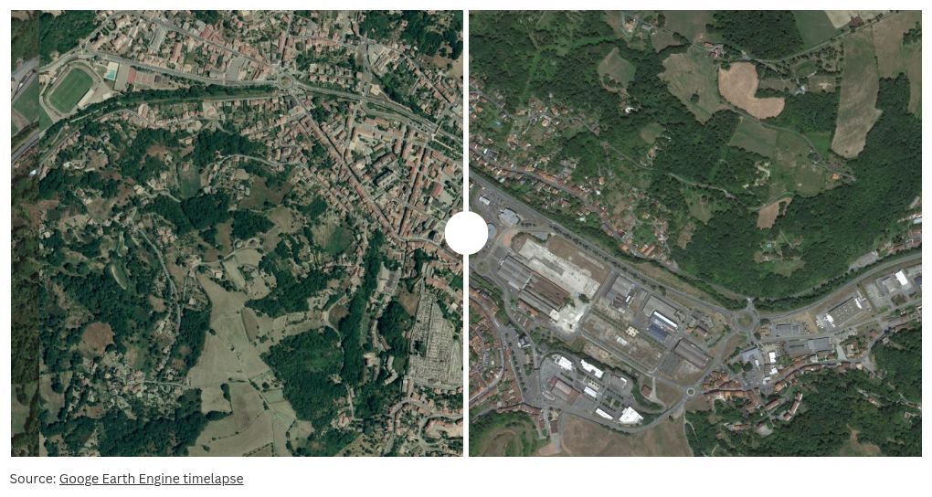
But from 2003, the quality of the photos improved. To the point of identifying the site of the Millau viaduct which would soon see the light of day. Drag the cursor on the image to the right or left to discover the before/after Millau Viaduct:
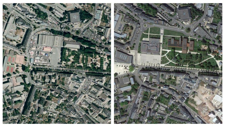
In 20 years, Rodez has changed a lot
The center of Rodez has transformed in the space of 20 years. In 2003, there was no Soulages museum or village hall, the tennis courts were lined up next to the Paul-Lignon stadium, and the fairground garden did not have quite the same layout. A blatant evolution in two images, in 2003 on the left then in 2018 on the right.
In 2003, the Bourran district was just emerging from the ground. We can see the first buildings and the numerous construction sites in progress at the time, in comparison to what Bourran has become today.
Some cities before/after
Here are pictures of a before/after of some municipalities in Aveyron.
.