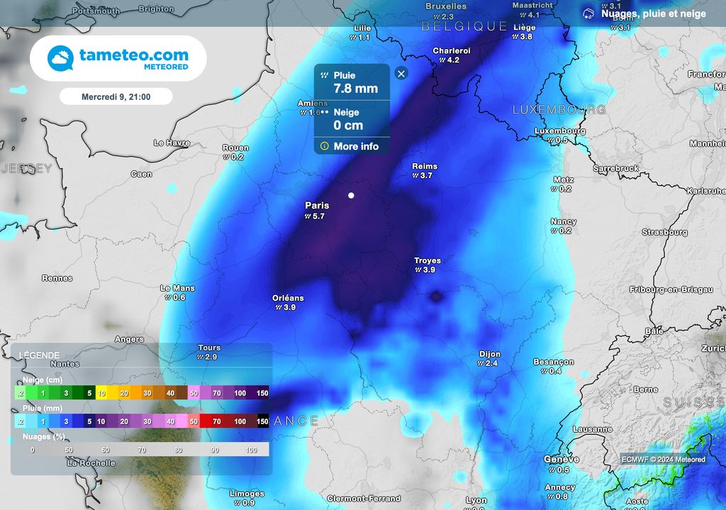


Ex-Hurricane Kirk has been bringing torrential rains since last night. Locally, nearly 100 liters of water fell per square meter in the Pays de la Loire. Heavy rains continue in Île-de-France. Seine-et-Marne has been placed on red alert due to the flooding of the Grand Morin.
Ex-Hurricane Kirk Brings Torrential Rain over a large part of France this Wednesday. The quantities of water are even phenomenal in places, with accumulations which locally approach 100 liters of water per square meter in the Pays de la Loire.
Heavy rain will continue over the next few hours and will even intensify in places. This will be the case in Île-de-France, where significant rainfall is expected until the middle of next night.
Therefore, a red alert was issued by Vigicrues for the flood of the Grand Morin in Seine-et-Marne.
What should you actually expect? Find our latest forecasts in this article.
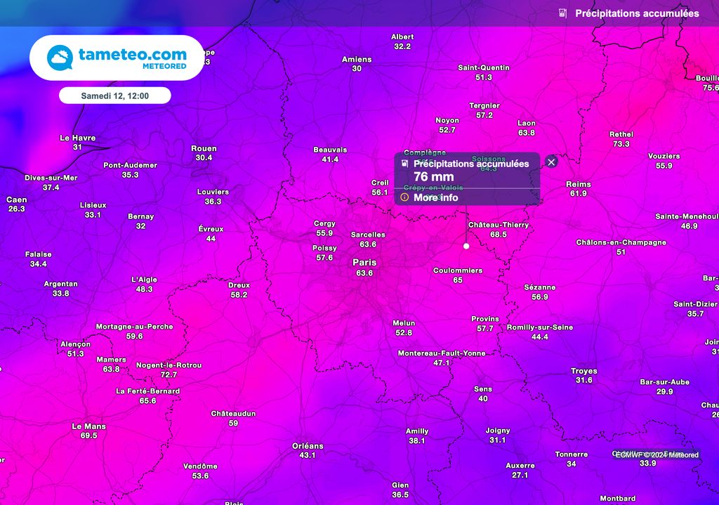
Red alert in Seine-et-Marne
Vigicrues has therefore placed the department of Seine-et-Marne on red flood alert. Rainfall accumulations could locally reach by the end of next night 80 to 100 liters of water per square meter in the Paris region.
Significant flooding is unfortunately to be feared in this department of the Paris region, and particularly in the surroundings of Pommeuse, a town already affected by flooding at the end of September.
How high will the level go?
According to the latest forecasts from Vigicrues, the level of Grand Morin could exceed 4 meters next night. The peak of the flood is not expected before tomorrow morning in the Pommeuse sector!
The expected flood on the Grand Morin will be higher than that at the end of last month, but also to the last major flood of 2016, where the level rose to 3.42 meters.
What is certain is that the next few hours are going to be complicated in this sector. The waters are expected to rise quickly and you should be extremely careful if you live in this area!
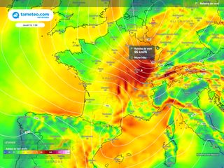
Moreover, 35 departments are placed on orange alert for heavy rain, floods and strong gusts of wind.
Particular vigilance also concerns the Alpes-Maritimes, where heavy thunderstorms are forecast over the next few hours. A significant risk of flooding is also likely in this department.
The Kirk depression will move towards Germany next night. Calmer weather conditions are therefore expected from tomorrow, despite numerous showers still forecast tomorrow morning in most regions.