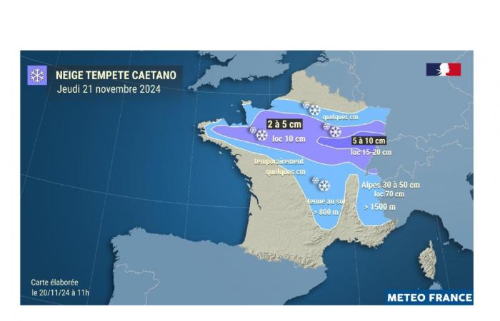
With the sudden drop in temperatures, you may have scratched your car this Wednesday morning, November 20. With temperatures oscillating between 0 and 5°C, Météo France has therefore decided to place the Oise on snow-ice yellow vigilance from 7 p.m. Wednesday evening… and for the whole day of Thursday, November 21.
At the edge of orange in the Ile-de-France departments with the snowfall forecast on an axis going from North Brittany/Normandy to the Grand-Est. This is linked to the circulation of the Caetano depression “bringing snowfall to the southern part of Picardy from midday”.
Read also: 100 on-call officers 7 days a week until March 17, 2025, 4,056 km of road monitored during winter in the department
The first snowflakes during the day on Thursday?
For Météo France, it is therefore not “it cannot be ruled out that we will have accumulations that could go beyond 3 cm locally, due to the uncertainty on the positioning of the snow axis more or less north” this Thursday. It’s something to watch out for then! In the meantime, stay safe on the roads.
France


