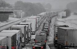
Could snowball fights take place on the plains this week in France? While it is currently impossible to answer this question with certainty, several signals point to snow showers at low altitude for Thursday.
The week ahead is marked by a clear change in the weather. After a generally calm period since the end of October, with rare exceptions, the anticyclone which was located over the country is moving away towards the Atlantic. The disturbances coming from the Atlantic will then continue.
A descent of polar air will also occur in the middle of the week, which will lower temperatures. This very cold mass will come into contact on Thursday with a warmer and humid mass coming from southern Europe. These conditions are favorable for the occurrence of snow at low altitude.
Several variables difficult to anticipate
But several variables must be taken into account. The first: humidification of the polar air mass must take place. This seems certain. The second: on the plains, the difference between snow, rain or simply nothing at all can be down to just one or two degrees. This very small variation is very complicated to anticipate. The third point is to determine where precisely the depression which comes into play in the possible formation of snow will be located. Its precise positioning is decisive because, within a few dozen kilometers, it can, for example, encounter relief or not at all, which influences snowfall. This is also a particularly complex element to anticipate several days in advance.
For the moment, Météo France is choosing to think broadly. As part of its forecast of dangerous phenomena, the organization estimates, this Sunday, that the entire country could be affected by snow and ice on Thursday. “A disturbed and cold passage is expected over the country and can bring snow to low altitudes or even to the plains. The exact location of this phenomenon needs to be refined,” explains Météo France.
Furthermore, even if all the variables go in the direction of snowfall in the plains, two other elements remain to be taken into account. On the one hand, the quantity remains uncertain. On the other hand, for the snow to hold, the ground must have cooled significantly. However, despite the morning frosts, in most cases they should not be cold enough for the snow to hold easily, unless it falls heavily.
For the moment, it is therefore only possible to reason in terms of probabilities. The maps of different weather models also reflect current uncertainties. But everyone agrees on one point: snow will fall on Thursday at low altitude. Rather, it is the location that remains very uncertain.
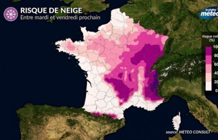
With the help of altitude, the weather channel assesses the chances of snow falling on the various massifs as 100%. In the regions of the northern half of the country, it makes the probability oscillate between 0 and 80% with chances increasing towards the East.
On the side of the ECMWF, the European Center for medium-term weather forecasts, it is rather the area between the west of the Massif Central, Normandy and Brittany which would be the most exposed.
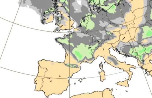
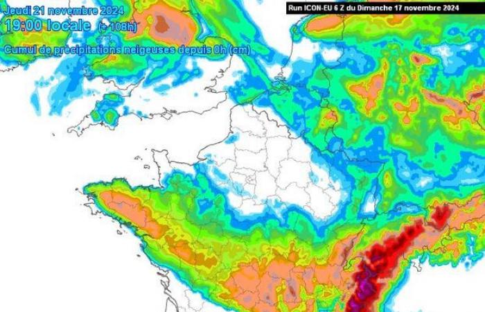
This signal is quite similar to what the German Icon model offers. The northernmost regions of the country, including Île-de-France, would remain away from the snowy zone.
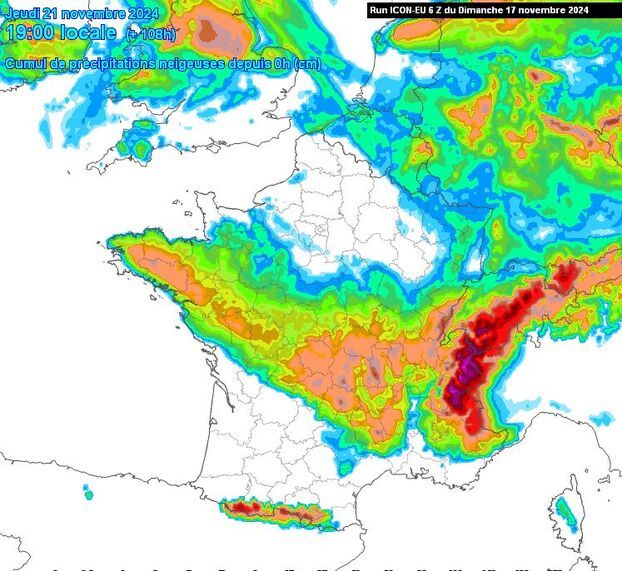
On the Arpège side, one of the Météo France models, the map of which is provided by Météociel, it is above all an axis going from Normandy to Burgundy, passing through the south of Île-de-France, which would be affected, in addition to the massifs.
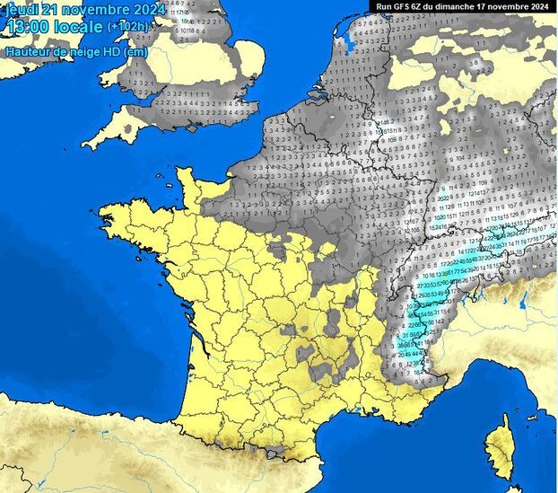
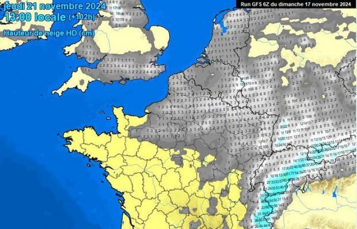
Finally, the American GFS model expects a slight dusting in the north-eastern quarter of France. Since Friday, GFS has continued to reduce the amount of snow and reduce the area concerned.
These maps do not yet constitute a forecast and do not give any indication concerning possible ground holding. Weather models are updated several times a day. About this possible snowy episode, they have all been groping for two or three days. The uncertainty could last until just a few hours before the showers, due to the many conditions that must be met for this snow to fall, or even stick to the ground.

