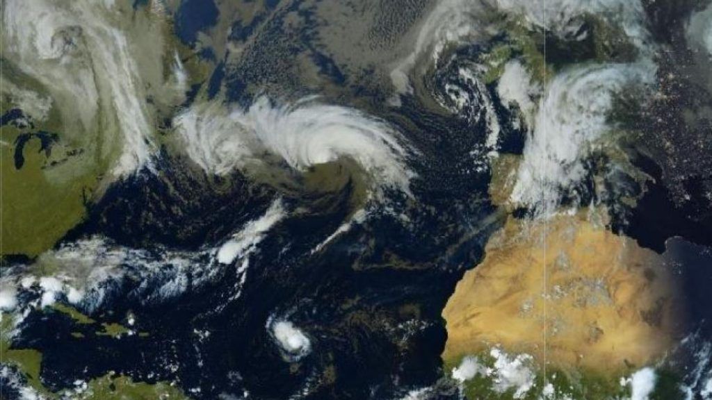
Ex-Hurricane Kirk, currently in the middle of the Atlantic, is approaching the French coast. According to weather models, it will cross France on Wednesday and Thursday from west to east before hitting Germany. “ A strong gale, or even a storm, is expected, first on the Atlantic coasts between the end of the day Wednesday and the night, then in the interior of the country with gusts of around 100 to 120 km/ h at the coast and 80 to 100 km/h, locally 110 km/h inland », predicts Météo France.
This depression will be accompanied by an active disturbance, “ well supplied with soft, humid air of tropical origin “. The highest rainfall totals are expected from the North-West to the Belgian borders, with 20 to 40 mm, locally 70 mm. The Weather Channel anticipates “ heavy rain » along the trajectory of the depression, from the central west to the north-east passing through the Paris basin, “ areas whose soils are already saturated with water. The risk of hydrological reaction will need to be monitored. » « Rainfall accumulations are expected to be remarkable between Wednesday and Thursday with the equivalent of a month of precipitation », Adds La Chaîne Météo.
50 km/h in the Nord and Pas-de-Calais
Many uncertainties still persist about the exact trajectory of the depression but it should avoid the Nord and Pas-de-Calais. Wednesday should be marked by sunny spells before the arrival of rain in the evening. These showers are expected to last until Thursday evening.